It is becoming widely recognised that humans are spending less time in biodiverse environments and have reduced interactions with nature. This reduced exposure to biodiversity has been linked to a wide range of chronic health conditions, such as inflammatory diseases, obesity, asthma and diabetes, with an endless number of lung infections. I propose a city to be created as a compact urban center promoting biodiversity, inclusion, connectivity and spatial experience. The city has a potential to enhance human health and get connected to the river edge by a dense network of multi-scale system of trails. The system of trails will work on interactions of residents with natural environment and productive landscapes bringing variable degrees of health benefits. The intervention will allow the residents to walk through, cycle through and pause along different productive landscapes getting different experiences. The different experiences and engagements with nature will benefit the residents socially, mentally and physically.
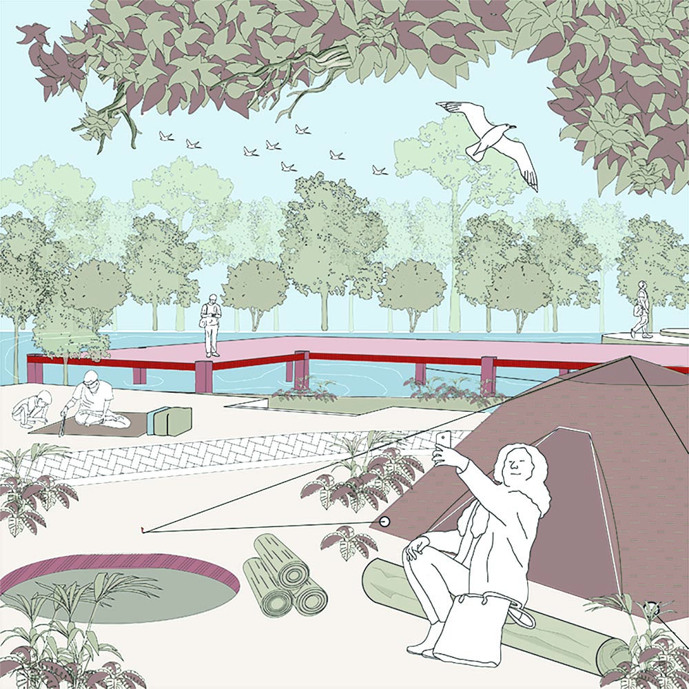
Along with this multi-scale system of trails the intervention includes different recreational pause points which will allow users to pause, engage and experience the changing character of productive landscapes.
Vision Plan 2030: Gandhinagar , Gujarat
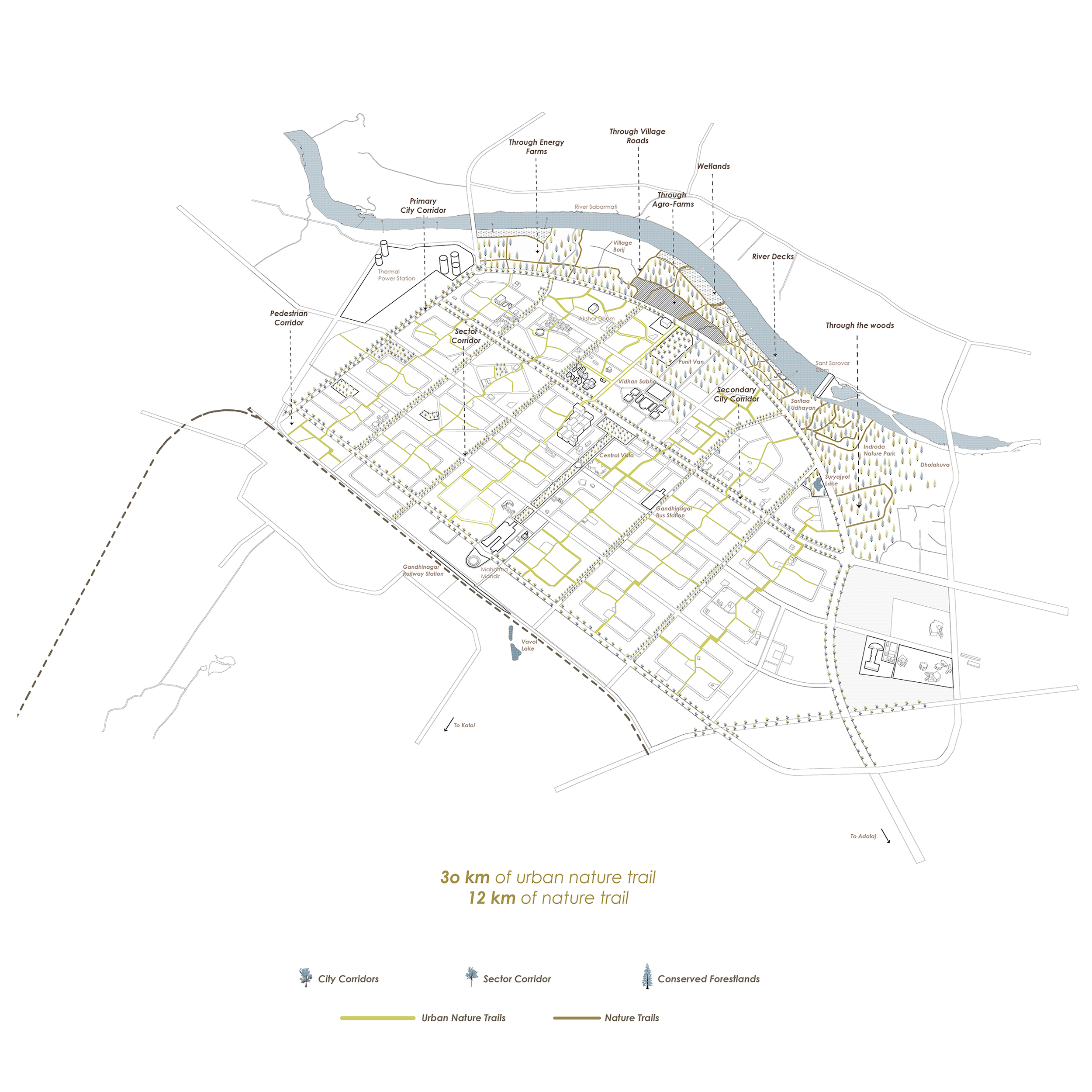
Gandhinagar is having a great potential to get engaged with biodiversity as it has river edge and a thick forest lands along the river Sabarmati which welcomes a variety of flora and fauna to exist there. The project aims to bridge this gap between biodiversity and the city by connecting the city to the river edge with a multi-scale system of trails. The project holds a great potential to regenerate the lost interaction of the residents with nature and allow them to engage through different productive landscapes.
The vision plan shows how the city connects to the river edge with a dense network of urban nature trails of 30 kilometers and nature trails of 12 kilometers which takes residents through different productive landscapes along the river Sabarmati.
The Trail Catalogue
A. Urban Natural Trails
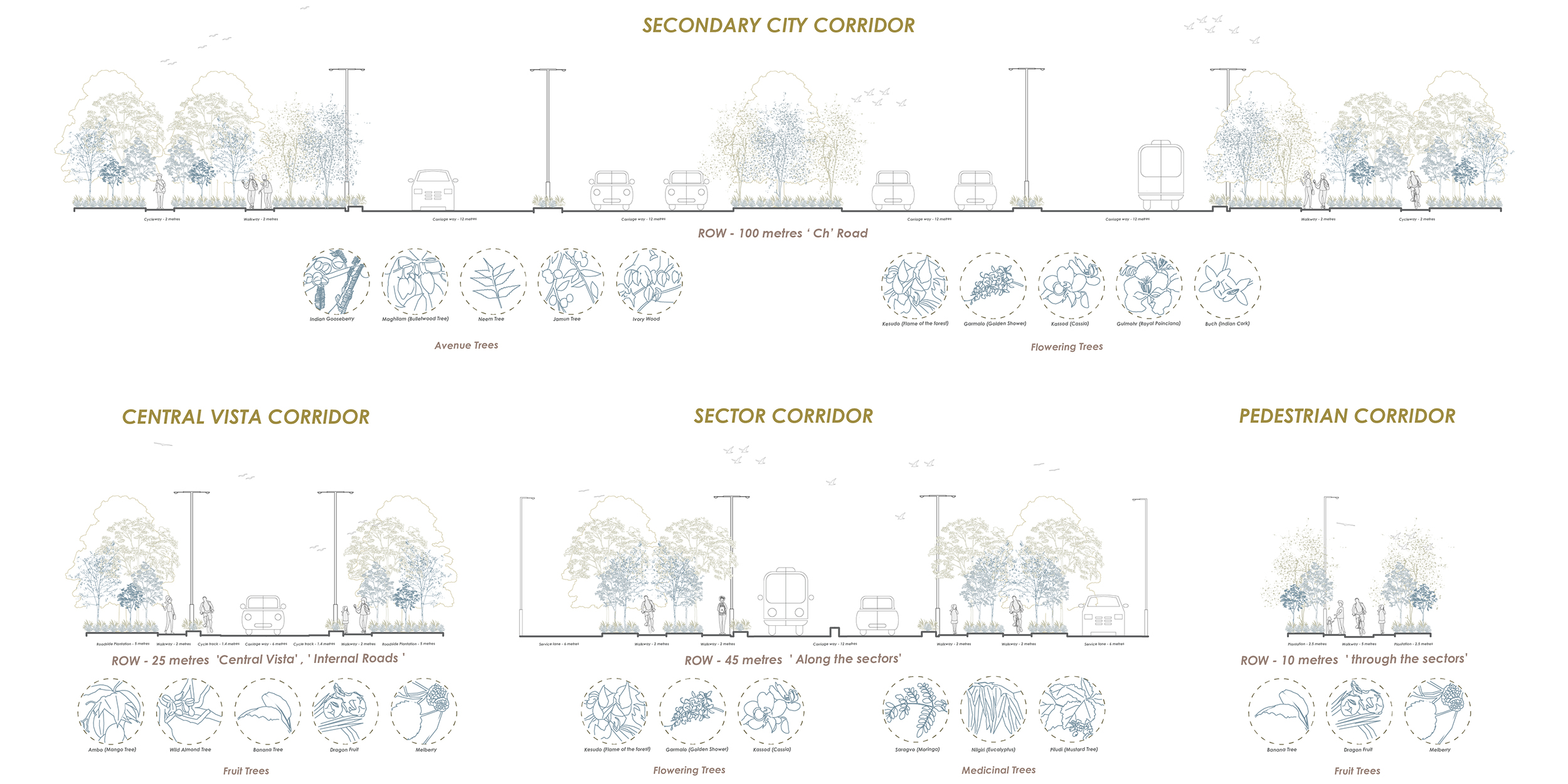
The city corridors, sector corridors and pedestrian corridors

B. Natural Trails
Along the agro farms, through the woods, through the energy farms, through existing villages, the river deck

Design Proposal: City Greenways
The multi scale system of trails meanders through different productive landscapes – Farmlands, Orchards, Forestlands, Swales, Meadows, Flowering beds and Riparian zone. Allowing the residents to learn different methods of farming on farmlands. Experiencing hiking and trekking on forestlands and swales as well as engaging with the river edge in riparian zones. Different trails meanders along different productive landscapes such as along the agro farms – farmlands and orchards, through the woods – forestlands and swales and the river deck – riparian and meadows.
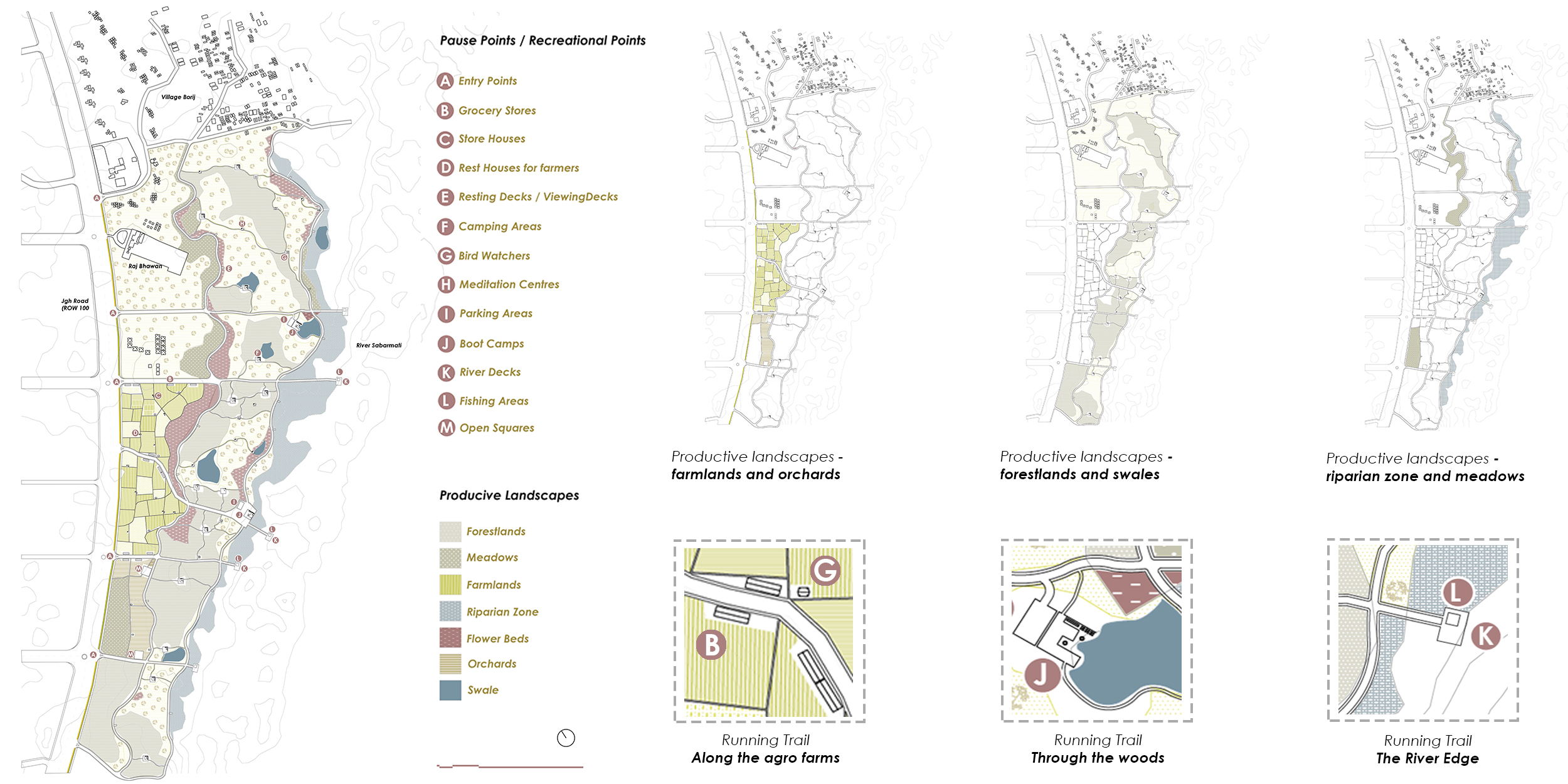
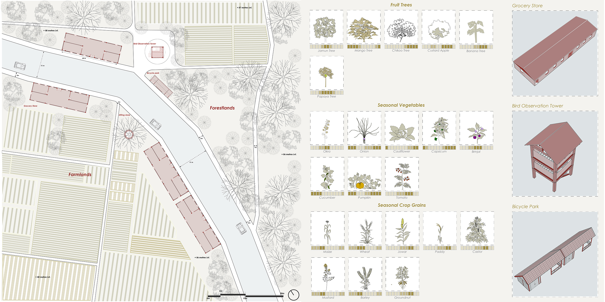
A. Along the Agro-farms: Farmlands and Orchards
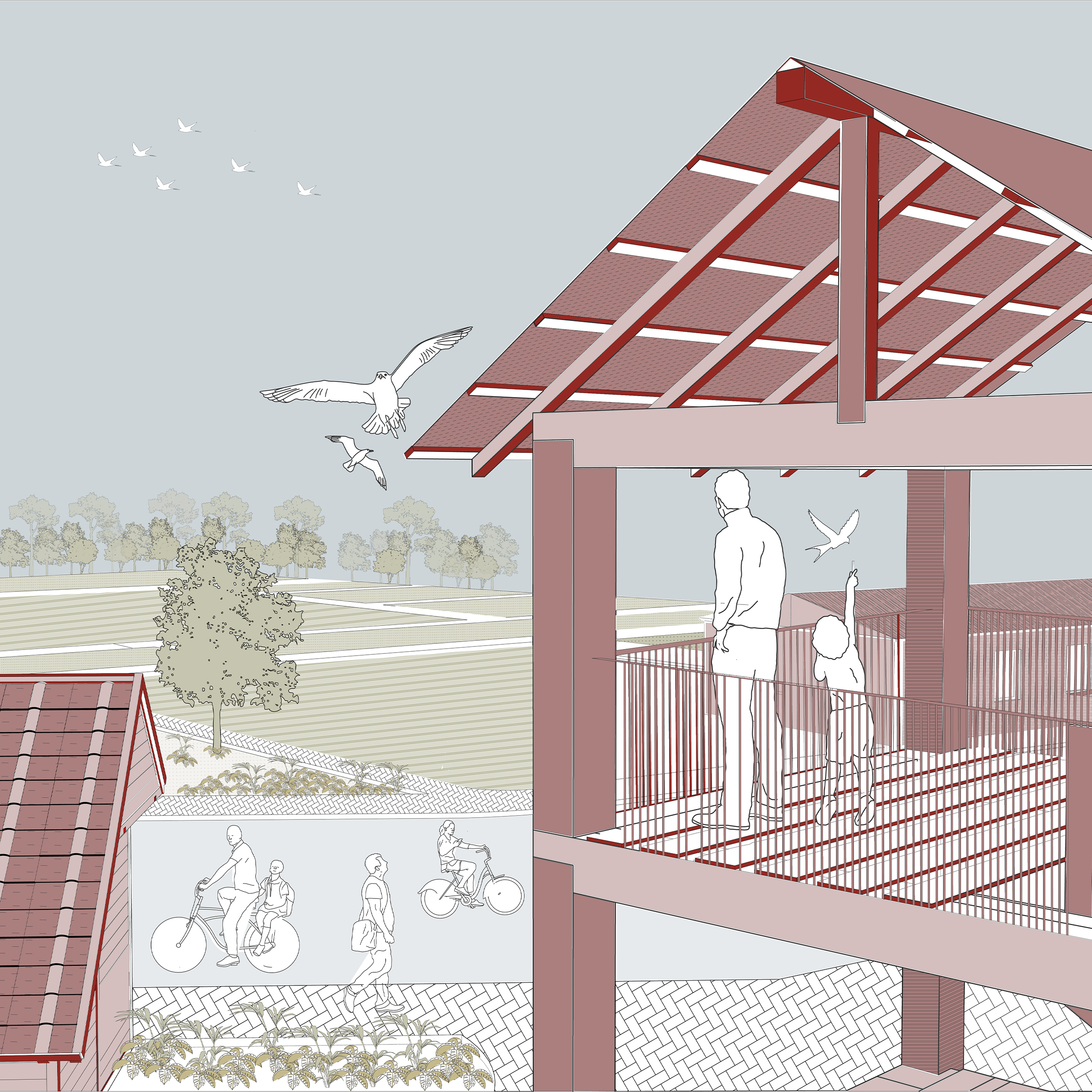
The system of trails along the farms engage the residents with the learning and engaging experiences of farming and allows residents to buy fresh farm veggies and crop grains while meandering on the trails. The recreational pause points such as bird observation tower engage the residents with natural fauna and flora.
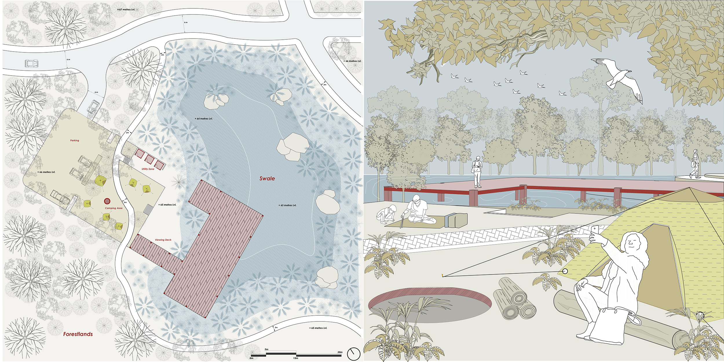
B. Through the Woods: Forestlands and Swales
The system of trails along the forestlands engage the residents with different hiking and trekking experiences and allows residents to pause and engage with the changing character of the forestlands. The residents will find out sitting places, viewing decks, meditation centers and bird observation towers in pockets of forestlands. The camping areas will engage the residents with camping and hiking experiences along the swales and in the forests.

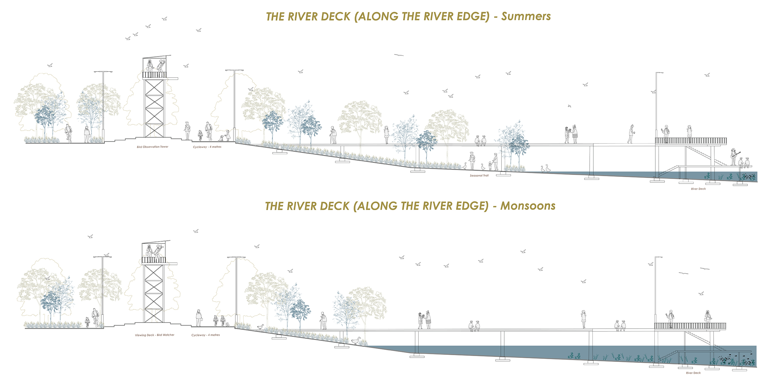
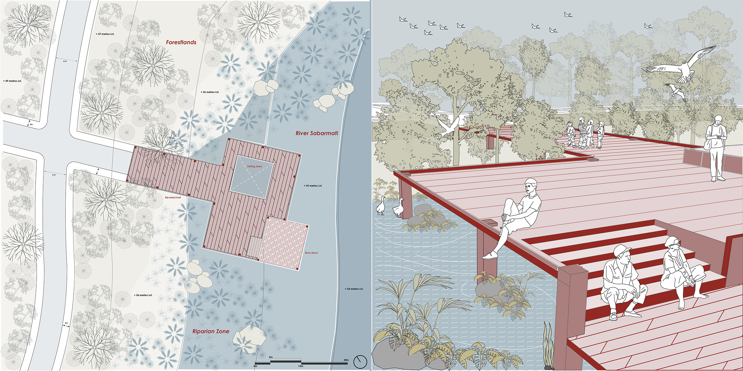
C. The River Deck: Riparian and Meadows
The elevated trail through the riparian zone engages the residents with different seasonal variations with natural vegetation at different seasons and the river – water level with changing seasons will create new experiences and engagements for the residents. The trail opens up to the river deck allowing the residents to sit, engage and interact with the river edge.
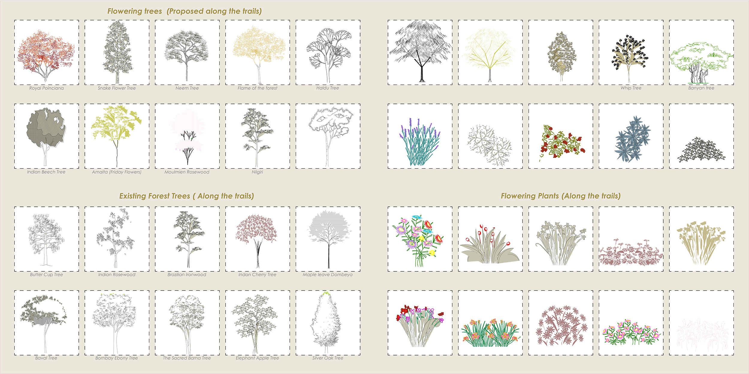
Planting Palette
The planting palette with different proposed flowering trees and plants as well as existing forest species that will be planted along the trails for changing the character along the trail in terms of color, smell, foliage, density and changing landscapes.