The project questions the anthropocentric development and the dominance of human activity that is taking over nature. The stretch of river edge in Gandhinagar is still left unexplored offering a matrix of plantation, villages, and wilderness patch which should not only be preserved but also enhanced to support biodiversity. This is also a great amenity for the residents to come and explore. Project ‘Ukiyo’ creates almost transient, unobtrusive architectural interventions that will allow for minimal human exploration in a sensitive micro ecosystem, and embed new programs for native plants and animals to take over. Thus the project wants to create a harmonious relationship between human and nature so that they both coexist.
Transient Architecture
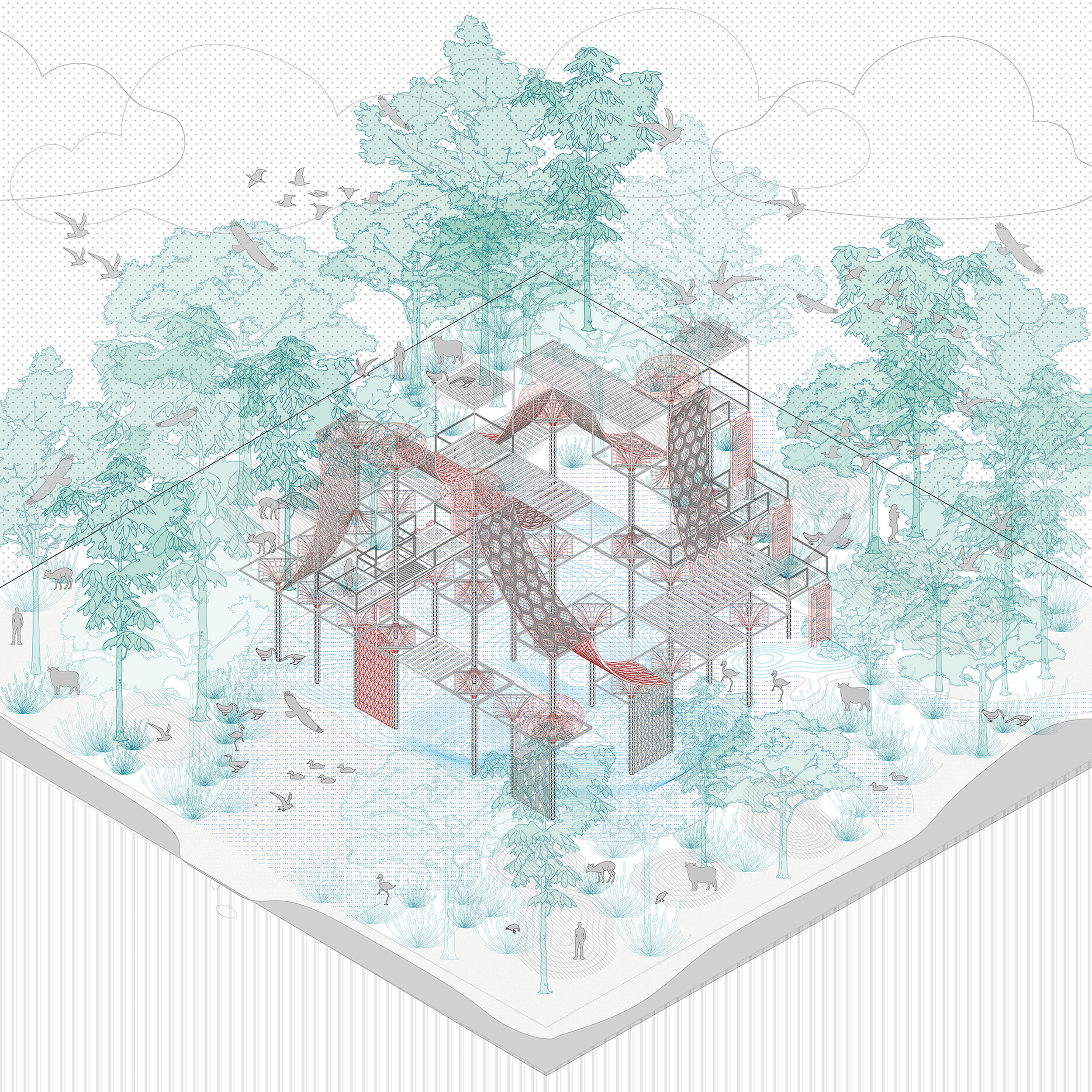
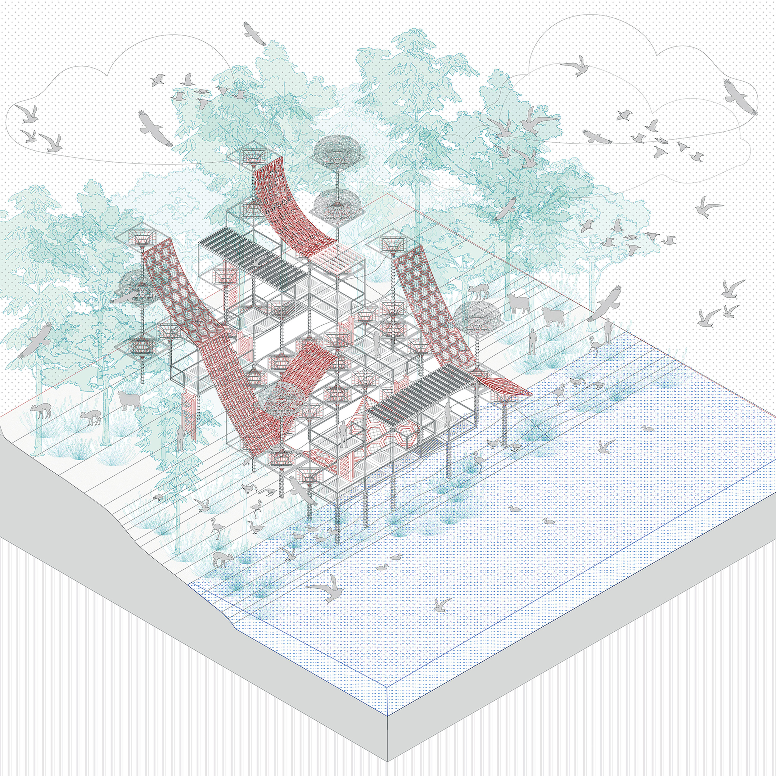
These were the first conceptual ideas and imagined architectural interventions to support various natural processes that could become habitat spaces. Sitting above different ground conditions found on site they house varied compositions of birds, insects, flowers and other vegetation.
The Existing Wilderness
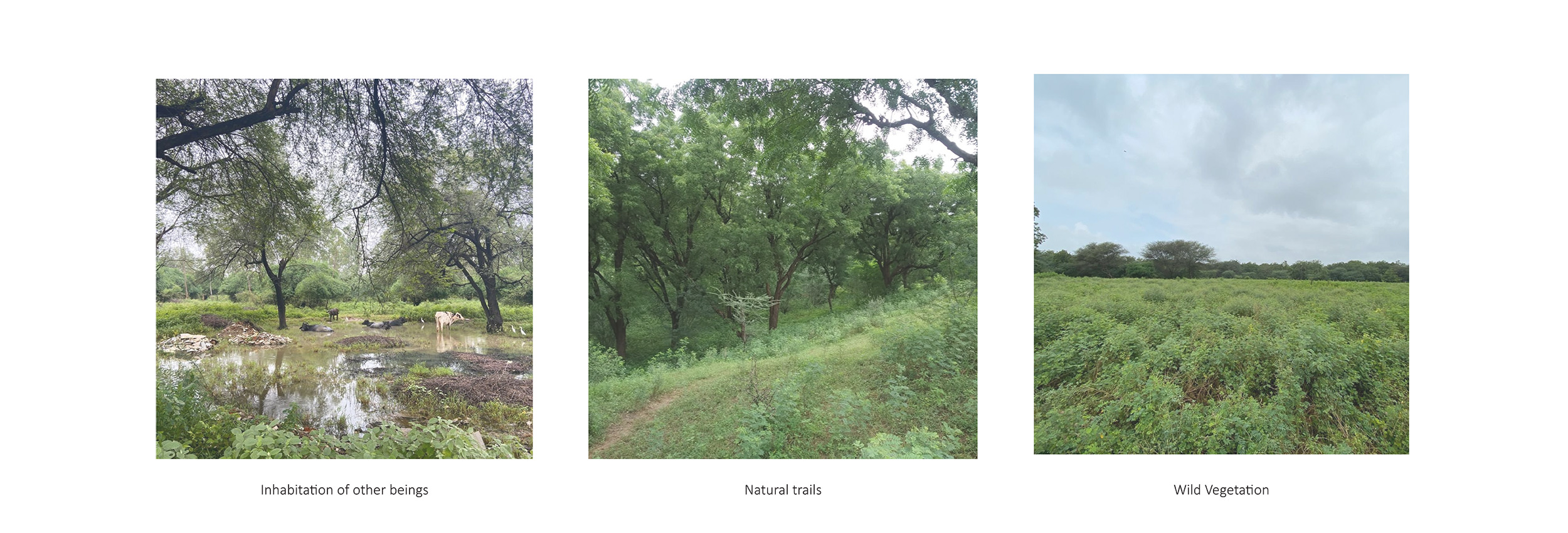
Due to the geography of the site next to the natural river edge and proximity to the dam, it has a myriad of vegetation species, different soil conditions and tree canopies. These images of site observations and walking through the landscape provided important learnings for design decisions. The ground conditions already offered a range of services that support biodiversity and natural processes such as existing swales, groves and floristic diversity.
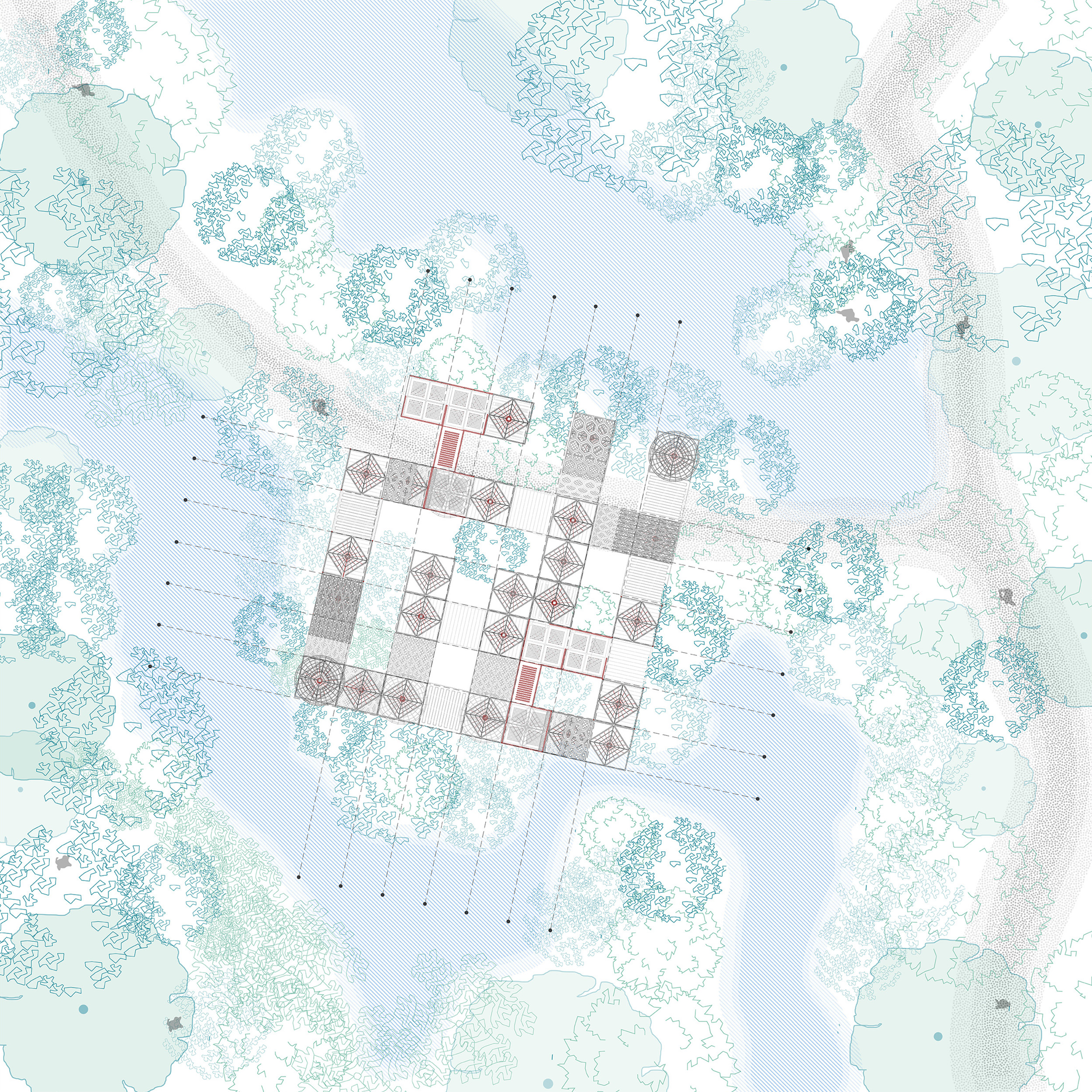
The Masterplan Mechanism
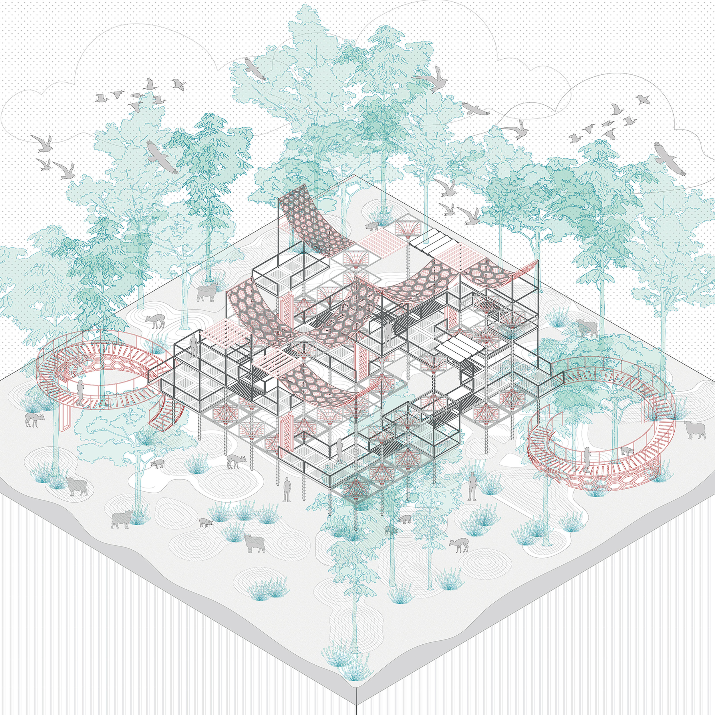
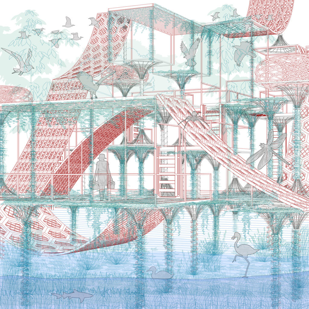
The overall design methodology applied on this site began with marking areas that need to be preserved and locating potential pockets for future development that can be accessible in the most sensitive way and does not fragment the site. After analysing existing topography, land cover, swale, movement of water and catchment network the trails were laid in consideration to all the layers with minimum cut and fill. With an extremely less footprint of less than 1 percent of the overall site, the sites for architectural interventions were overlaid- which would support vegetation and habitat spaces. The structures embedded lightly on the site were markers and viewing points for people to enjoy and acknowledge the mysteries of nature around from afar.
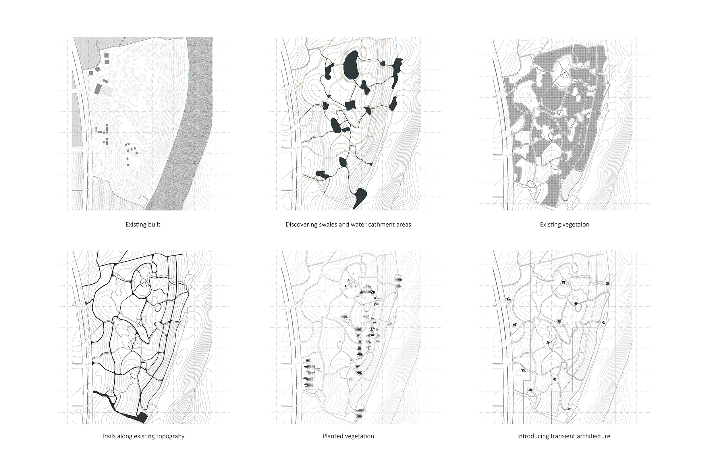
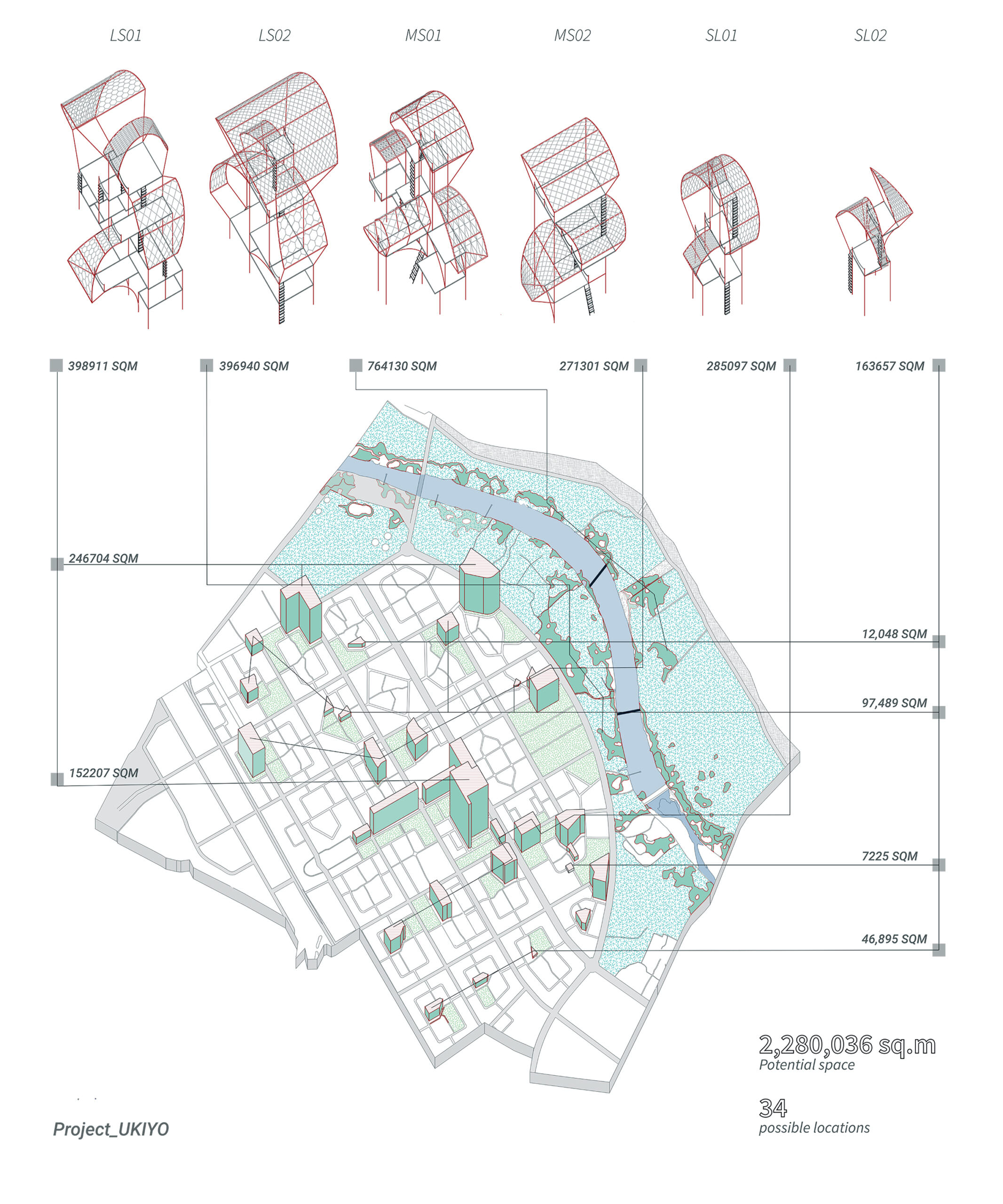
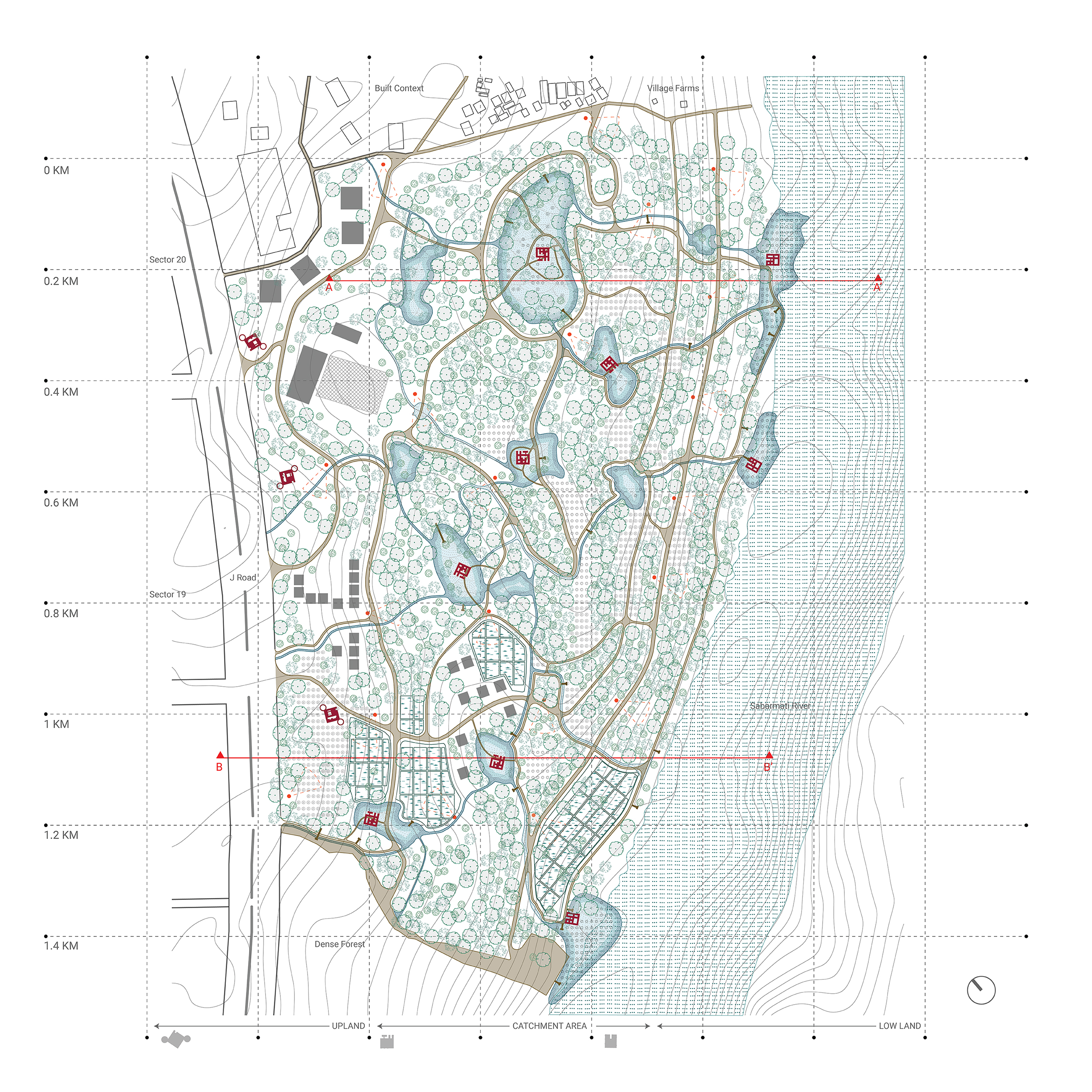
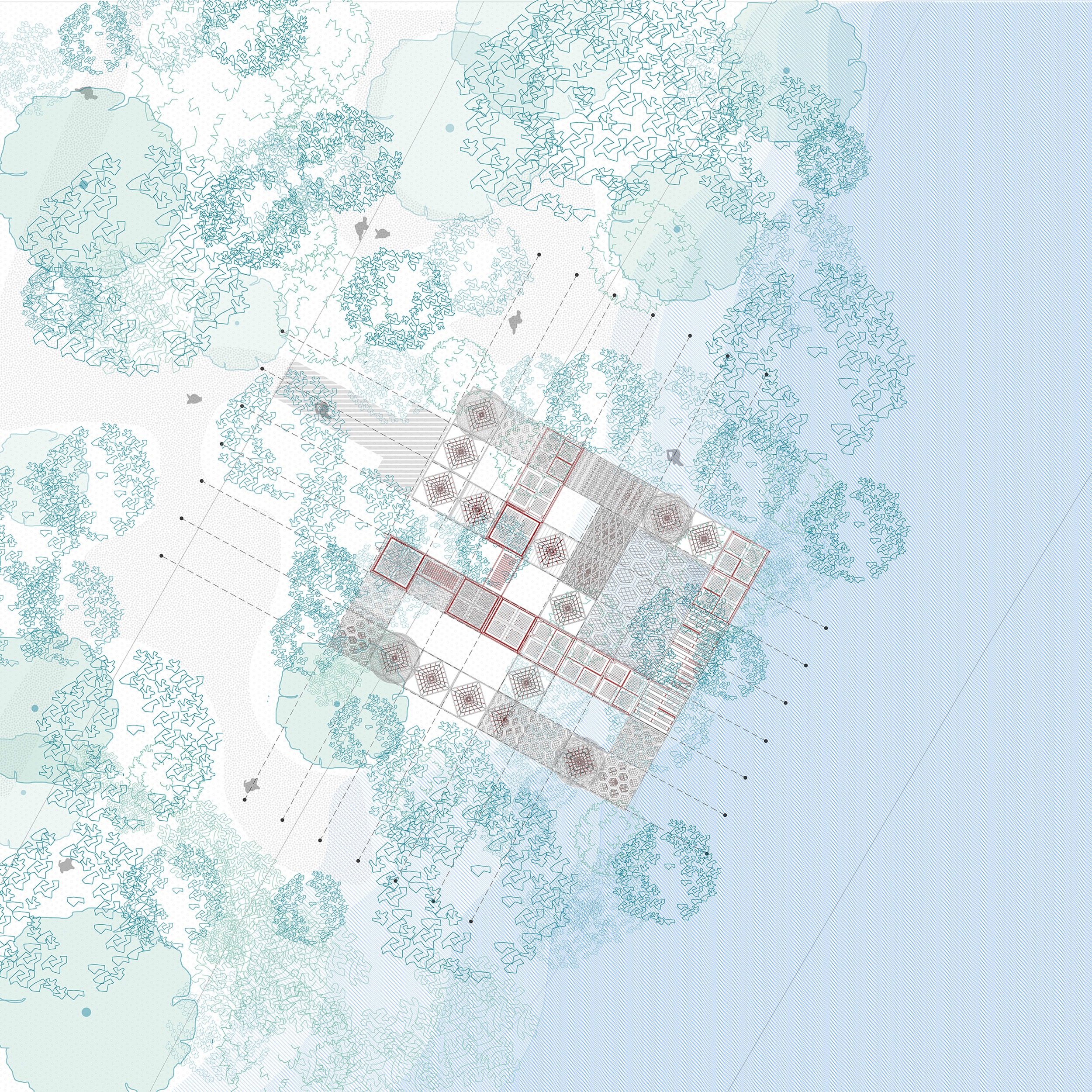
L Scale Plan
Site plan shows the juxtaposition of various layers – trails, micro catchments, and architectural interventions. The interventions are placed in response to the ground condition that make three distinct zones. The first zone is the patch near the J road is an upland area, the central zone has several small catchments that support different vegetation and small organisms. And, the third zone is river edge with riparian ecology that again supports and attracts many types of birds, bats, smaller aquatic animals, and vegetations.
The proposal plan retains the existing matrix of vegetation and land conditions and introduces new vegetation of nectar rich flowers and growing creepers in areas that are vacant. The plan also weaves the existing village and provides spaces for community farming. And the last layer of light infrastructures are introduced in three distinct zones that would over time be taken over by nature and become a ruin for humans and a house for other beings.
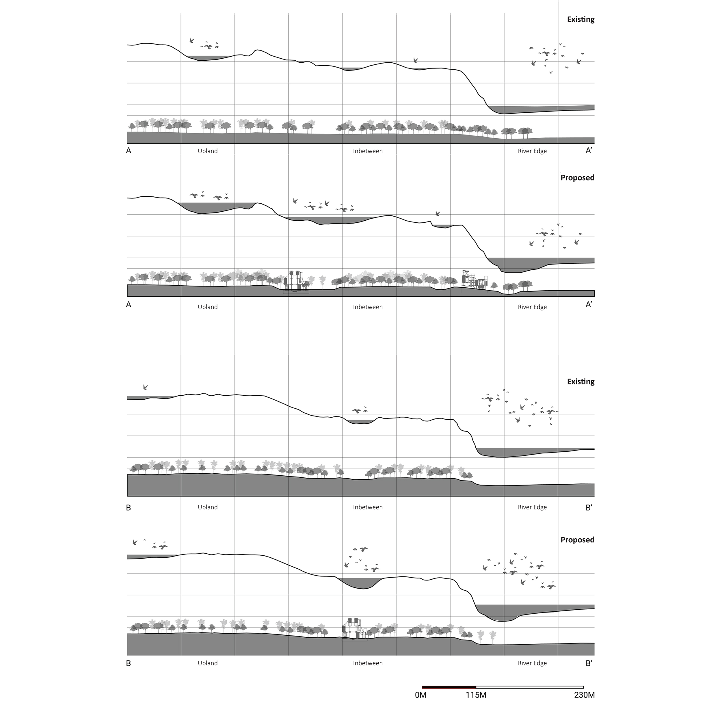
This shows the existing site sections that were taken along the horizontal axis to understand the existing topography and extent of vegetation present on the site. The values of the contours were extrapolated on the z axis in order to visualise water catchment areas.
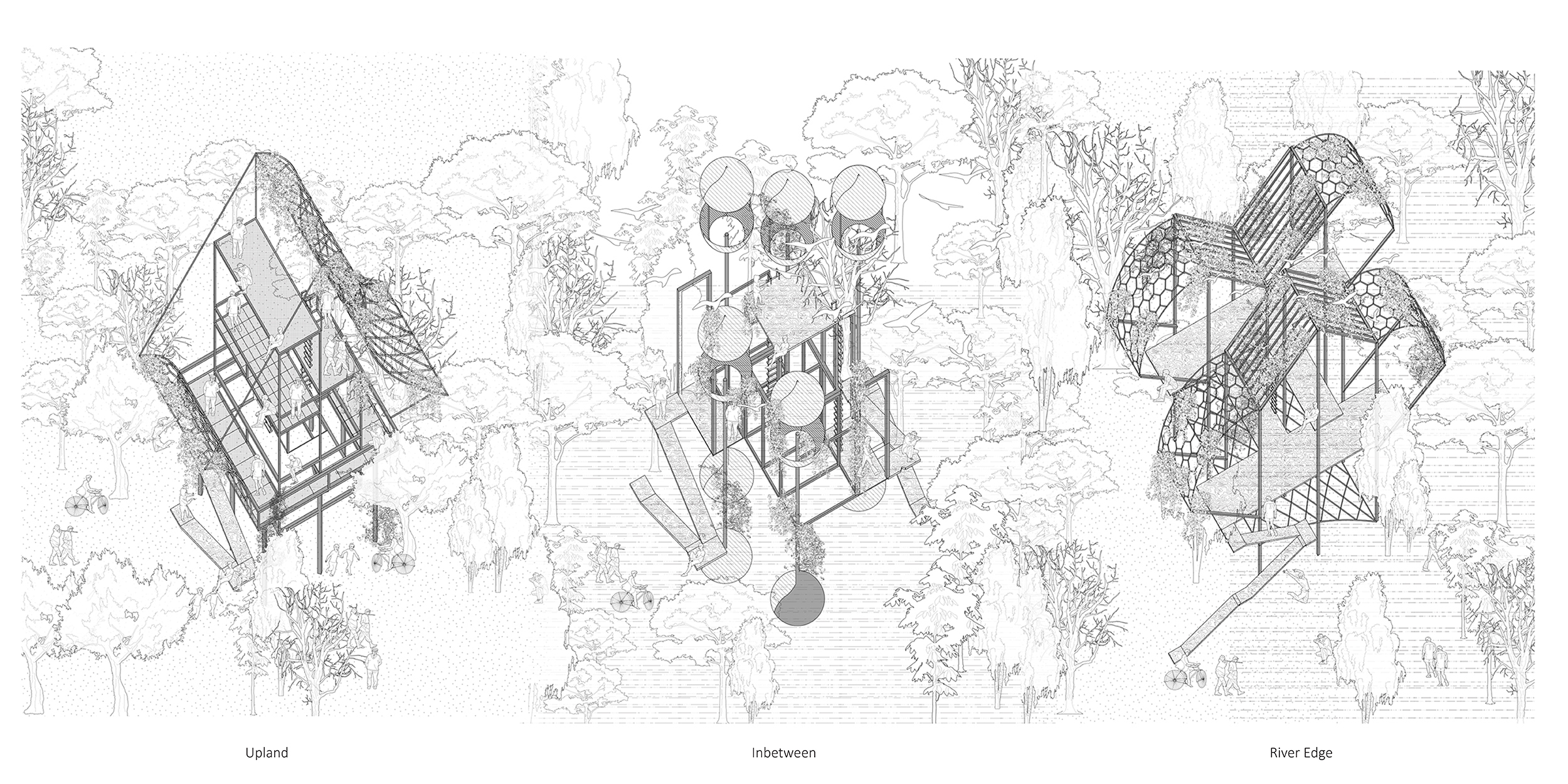
Upland
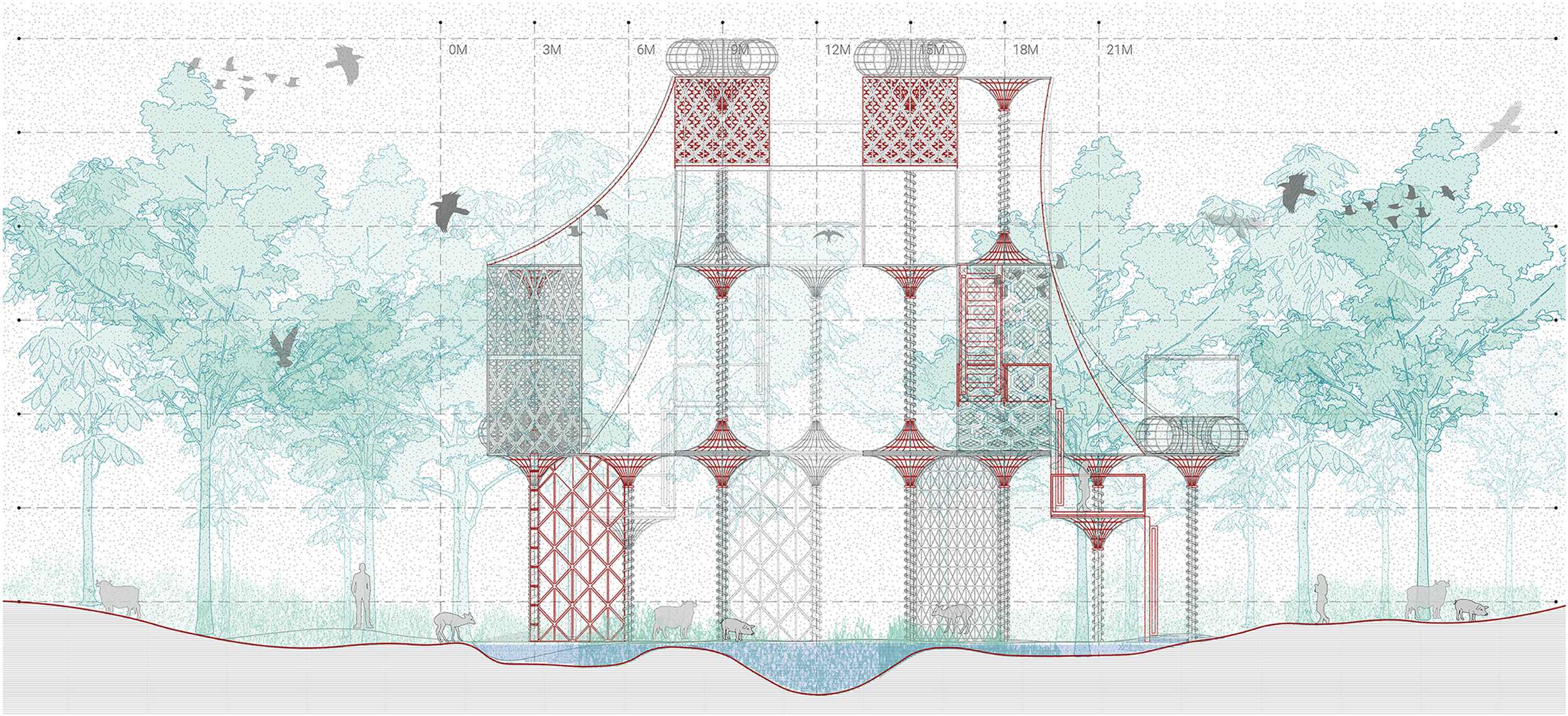
Uplands are land areas away from the riparian corridor on higher grounds mainly dominated by shrublands, grasslands and forests. The ability of uplands to retain soil and nutrients, absorb and release water, and buffer high-runoff precipitation events has a major influence on riparian condition. To make this kind of landscape more productive, there is introduction of architecture specific to upland condition, with vegetation planned in order to retain soil nutrition, and structure span over the land to retain moisture and provide habitation to birds, bees and bats that will be attracted as vegetation will thrive.
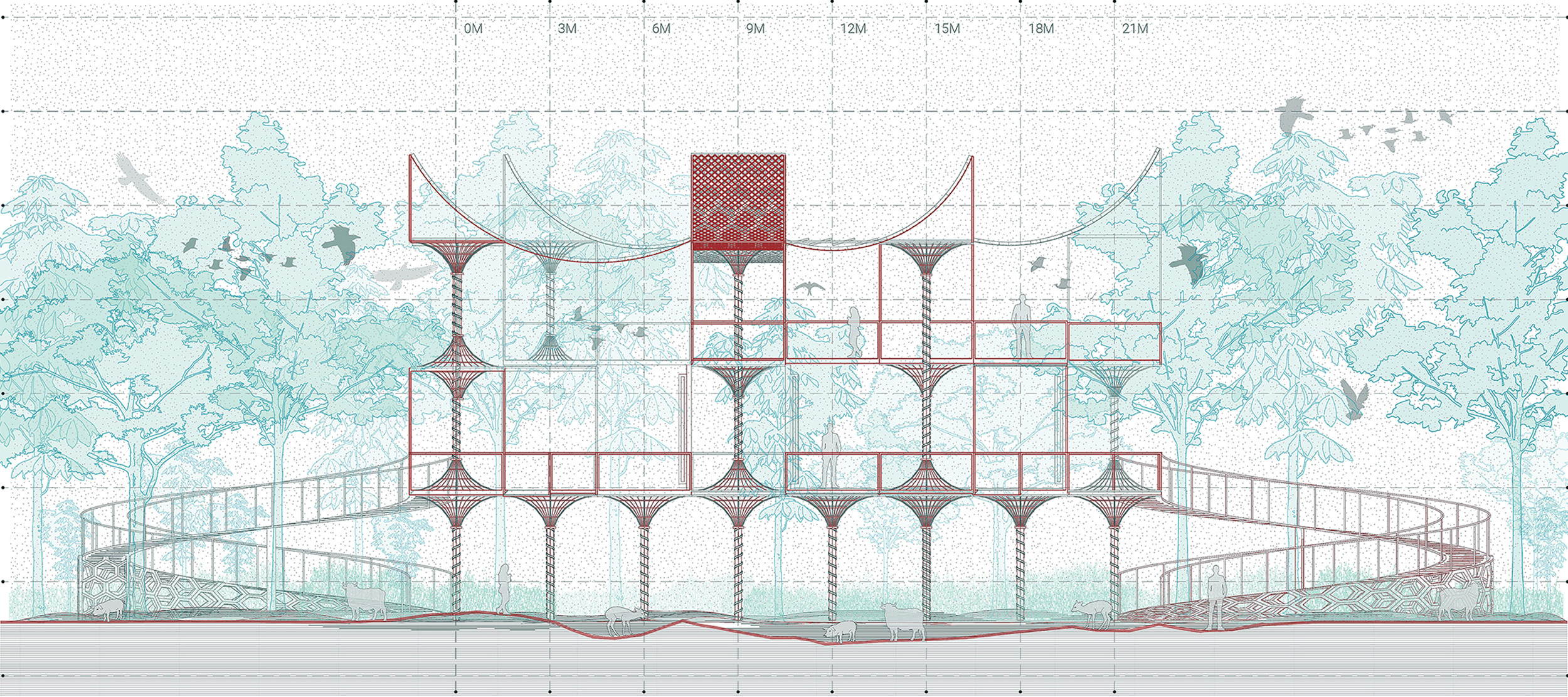
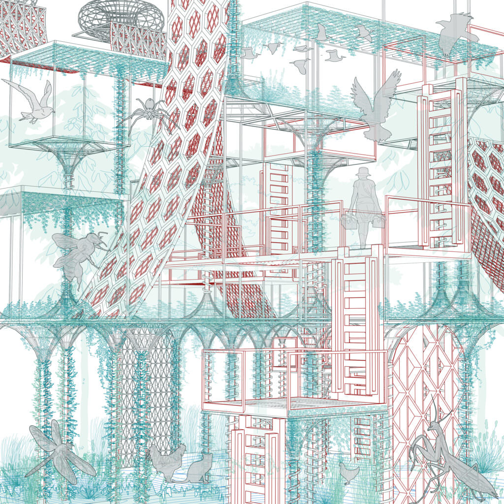
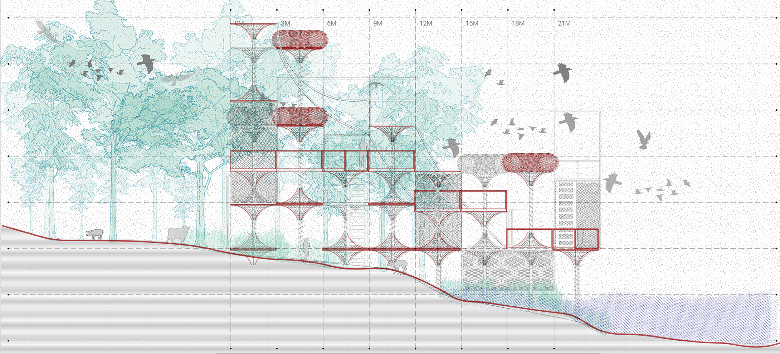
The Upland structure sits in the span of 25m X 25m – assembled using modular sizes such that the construction process is minimalistic and surrounding is left untouched. These specific upland structures have connecting decks and ramps for universal access, thus allowing humans to be an audience of evolving ecosystems. The canopies of structures are intentionally designed to provide both light and shade such that mixed habitation of various organisms can exist. The vegetation around this structure is carefully planned with creepers to blend the structure with the surrounding context and nectar rich flowers to attract various native species of birds and bees.
In Between
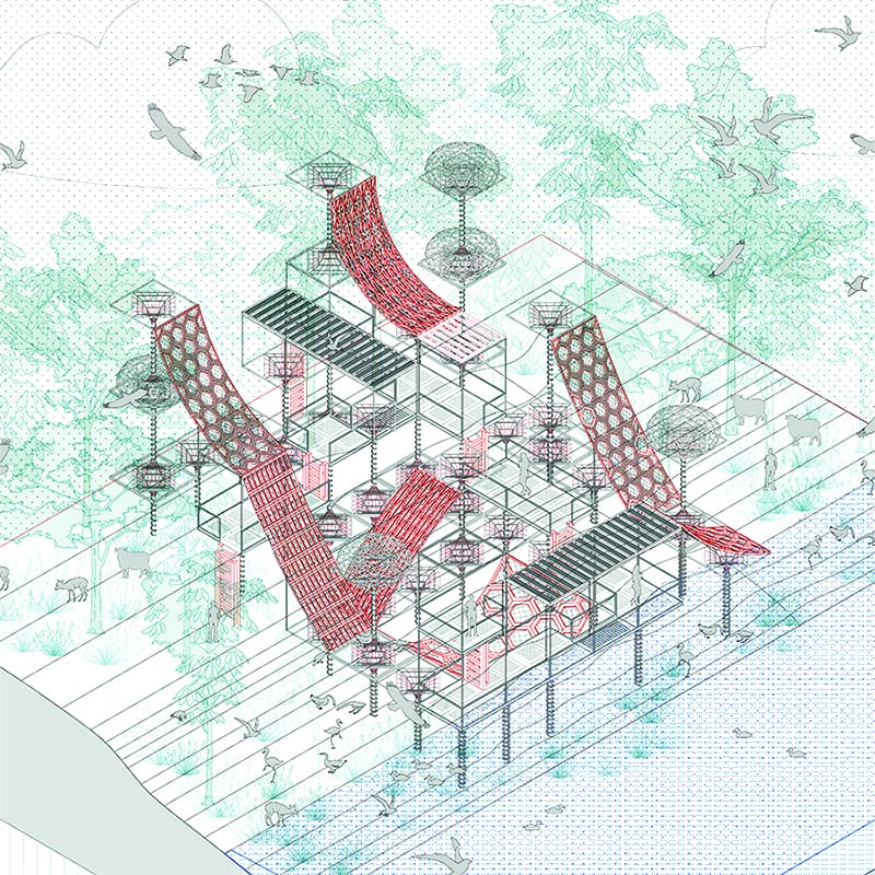
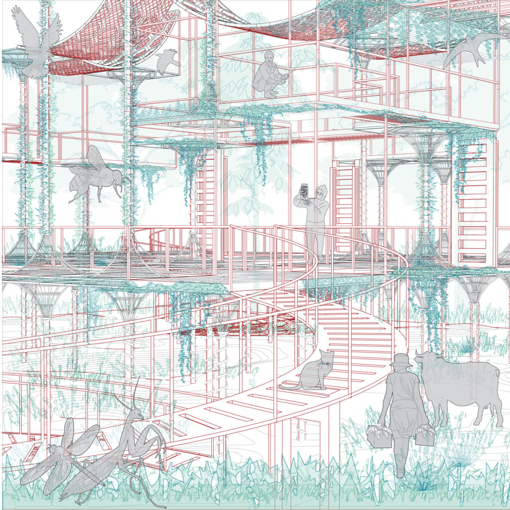
In-between are the middle grounds stuck within the uplands and river edge area. These in between catchment areas show three general characteristics: soggy soils, water-loving plants, and temporary water. These areas that are inundated or saturated by seasonal surface water are great at supporting vegetation typically adapted for life in saturated soil conditions and can also withstand spells of dry condition. Such ecological sponges are of great importance and support the overall ecosystem of the surrounding. Such type of land provides many benefits – food and habitat for fish and wildlife, including migratory species. In addition, they improve water quality through gradual percolation and help in ground water recharge. These areas are also ideal for recreational activities, education, and research. The structure sits on vertical columns with various canopies – volumes that inhabit vegetation and frames that provide structure to inhabit and porosity for light to penetrate on the ground surface.
The In-Between structure perches lightly above the ground that provides a continuous landscape on the ground. With geobiological material, the structure itself is enriched with qualities of attracting native species of residing or migratory fauna. And with availability of water, vegetation can thrive throughout the year – providing food for other beings that will inhabit in structure. The central idea is that with time, the structure dissolves in this dense nature and becomes a space of exploration and discovery on the river side. The accessibility to this structure is limited to certain smaller decks above ground that can become a vantage point for nature enthusiasts.
River Edge
The interface between land and river is rich in terrestrial biomes. The water table in the Sabarmati river fluctuates with the season and hydrophilic vegetation have thrived on the soft riparian edge. These eco-tones or transient zones are of great importance and need to be conserved due to its resilient vegetation which forms the most biodiverse patch. The designed structure is sensitively placed on the river edge considering water level throughout the year and also provides opportunities to look out into water from limited accessible decks.
The river edge structure with its large open canopies and framework under water provides foraging and feeding grounds for birds and other animals.. The idea here is to create a self-sustaining ecosystem where organisms can interact both with each other. Each microsystem of upland, in-between, and river edge in different parts are unique and attracts different forms of fauna on site.
The Palette
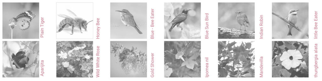
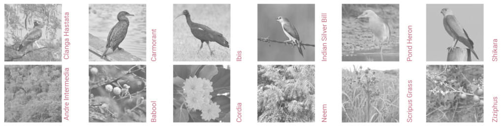
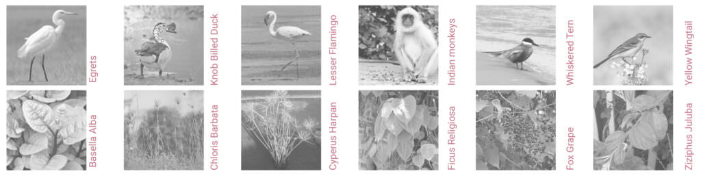
A native planting palette was selected that can also thrive in specific micro ecosystems. The palette consists of urban meadows with nectar rich wildflower fields which can grow with less maintenance and can attract a large body of urban fauna. Specifically the palette has six nectar rich flower plants and six creepers that grow along the existing vegetation. Also the palette is selected in a manner that throughout the year different parts of the site blooms on different months, creating active food rich patches for other organisms throughout the year.
Beyond Site: across Gandhinagar
The idea goes beyond the boundaries and looks at the overall network of sensitive ecosystems that can coexist with humans in Urban Landscape. Gandhinagar being one of the greenest cities in India, the definition of green needs to be questioned and understood. The lawns and large open plots with ornamental trees may provide a green cover, but have little value in terms of species richness, whereas the wilderness provides an active diverse ecosystem. The extrusion in the drawing here reflects the volume of open green area in Gandhinagar and the hatch shows wilderness around manicured lawns which needs to be made more productive.
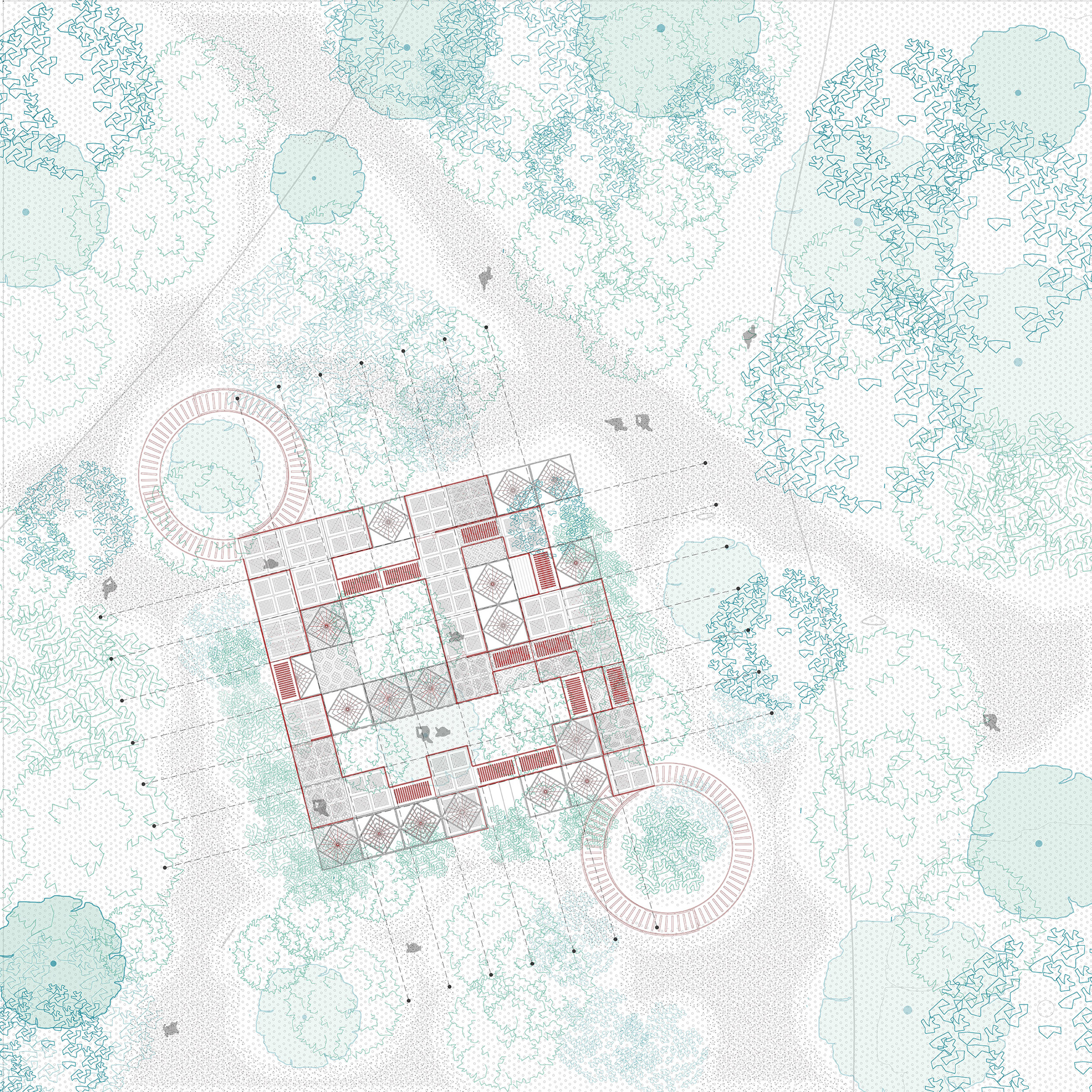
The idea here is to be sensible and minimalistic in approach towards nature as nature itself is the best architect of our surrounding. The XL plan sets up a structural framework which allows the ecosystem to dominate and humans to be an audience of its evolving landscape.