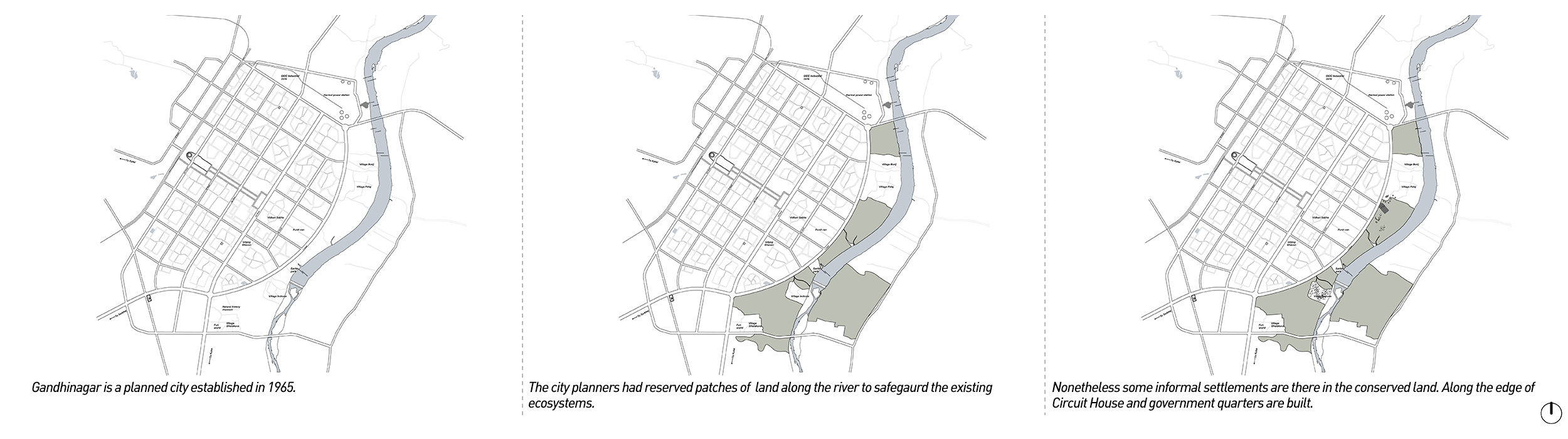
Though the land is conserved, there are some settlements that have come up. The land is often used as a grazing area by the villagers. With time, as the city grows, this patch of conserved land will have an increased real estate value and it is possible that land will be unlocked for future developments and construction.
This would adversely impact the existing ecosystem. before the city expands and engulfs these sensitive sites there is an opportunity to weave the flood plain and existing vegetation while proposing new programs and design that can integrate the landscape with the city, benefit inhabitants and strengthen river ecosystems. Through the project, the city is envisioned as a crochet of these wild, natural patches which exist around and within the city.
City Scale Vision
There are open land parcels that exist and around the city, which either have an ecological, economic or social value to it. The project aims at weaving these different landscapes ( open lands) together, in order to unlock their potential. For the premise of the project, the landscapes chosen are examined through the lens of ‘productivity’. Any piece of open land, which has the potential to give social, ecological environmental benefits to its inhabitants is considered to be a ‘Productive Landscape.’
The identification of open lands which are categorised under the following types:
1) Cultivable zones: The City is surrounded by agricultural land, and such land parcels shall be retained.
2) Collection Sites: Identifying land parcels where the distribution for selling of produce. For example, markets where the grown food can be sold, or spaces like community orchards, which are open to public, where people can come and pluck and collect various items that grow.
3) Conservation zones: the patches of lands are identified which need to be conserved as they are, like the forest area and the river edge.
4) Green Energy and composting zones: Places like composting site, where the city’s bio degradable waste is converted into compost, and places where it can be stored and packed in order to supply it back to the city.
5) Cultural zones: The existing public spaces to be reappropriated to match them better with the vision of productive landscapes, but majorly retaining its nature of being recreational public spaces.
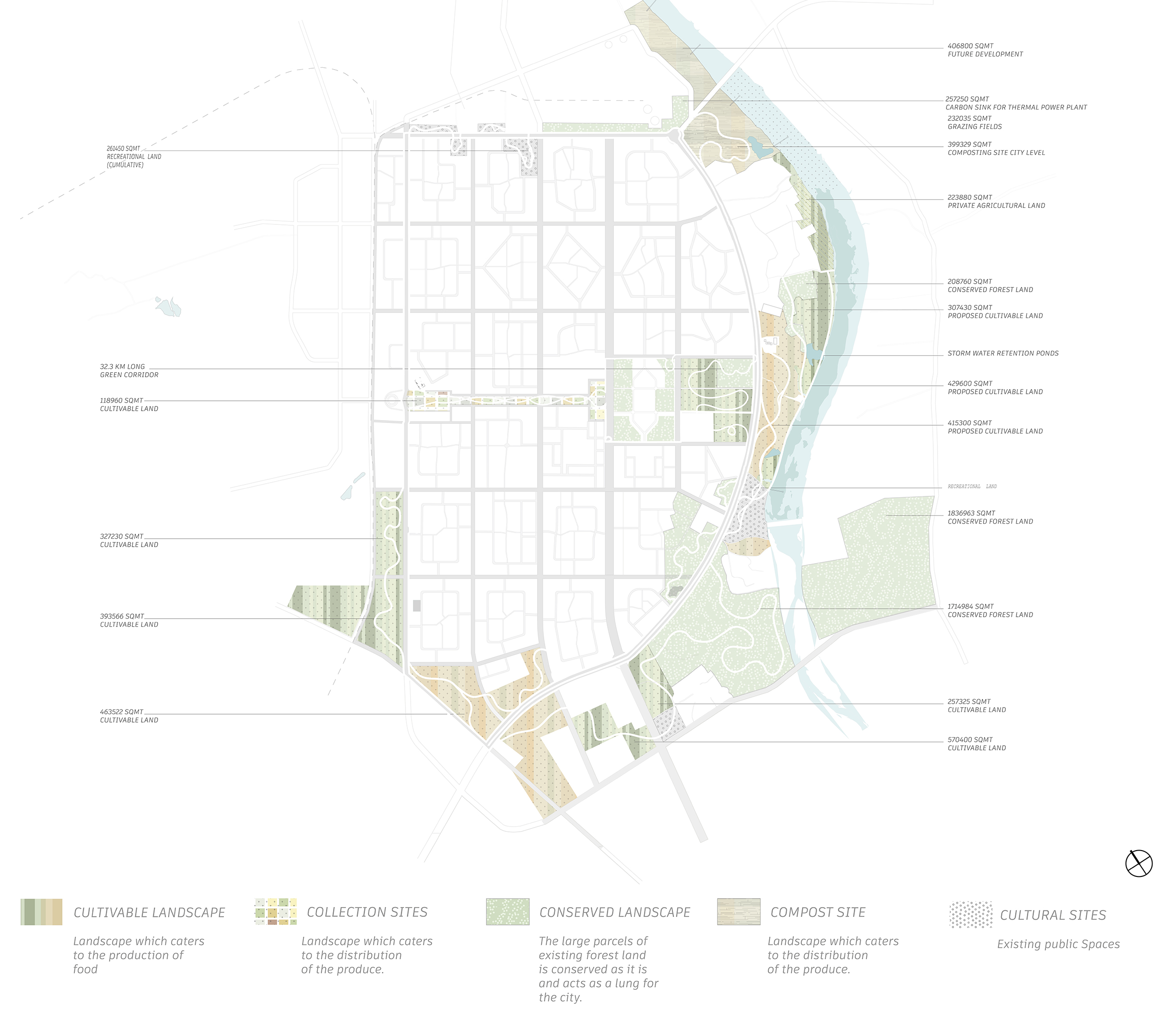
These different landscapes are weaved through a continuous pedestrianised and non-motorised corridor to create the ‘Crochet’.
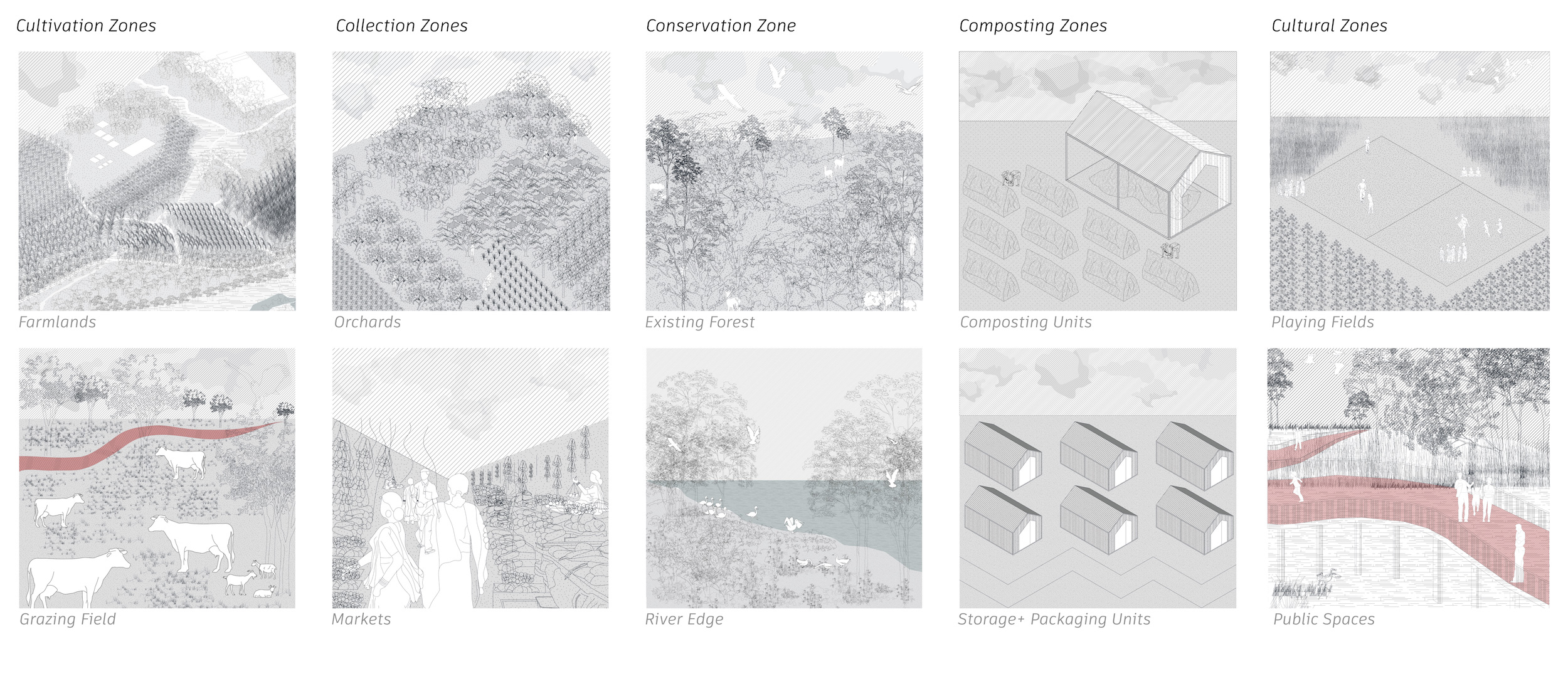
The catalogue constitutes of speculative visualisations for the different landscapes that are identified in the city. Through the project the aim is to unlock these visuals for the inhabitants of the city.
Most importantly, the project identifies the need to weave the river patch into city, so that a sensitive patch, can be saved from being engulfed by urbanization.
Re-imagining the River Side
(Crochet of Productive Landscapes on the river side)
The project identifies the River Patch as a site to test the crochet. Through the crochet, the aim is to enhance the ecosystems present on the site, and also bring the inhabitants back in the lap of nature where they can respectfully interact with the nature and learn the relevance of these different productive landscapes.
The process followed for the crochet is as follows:
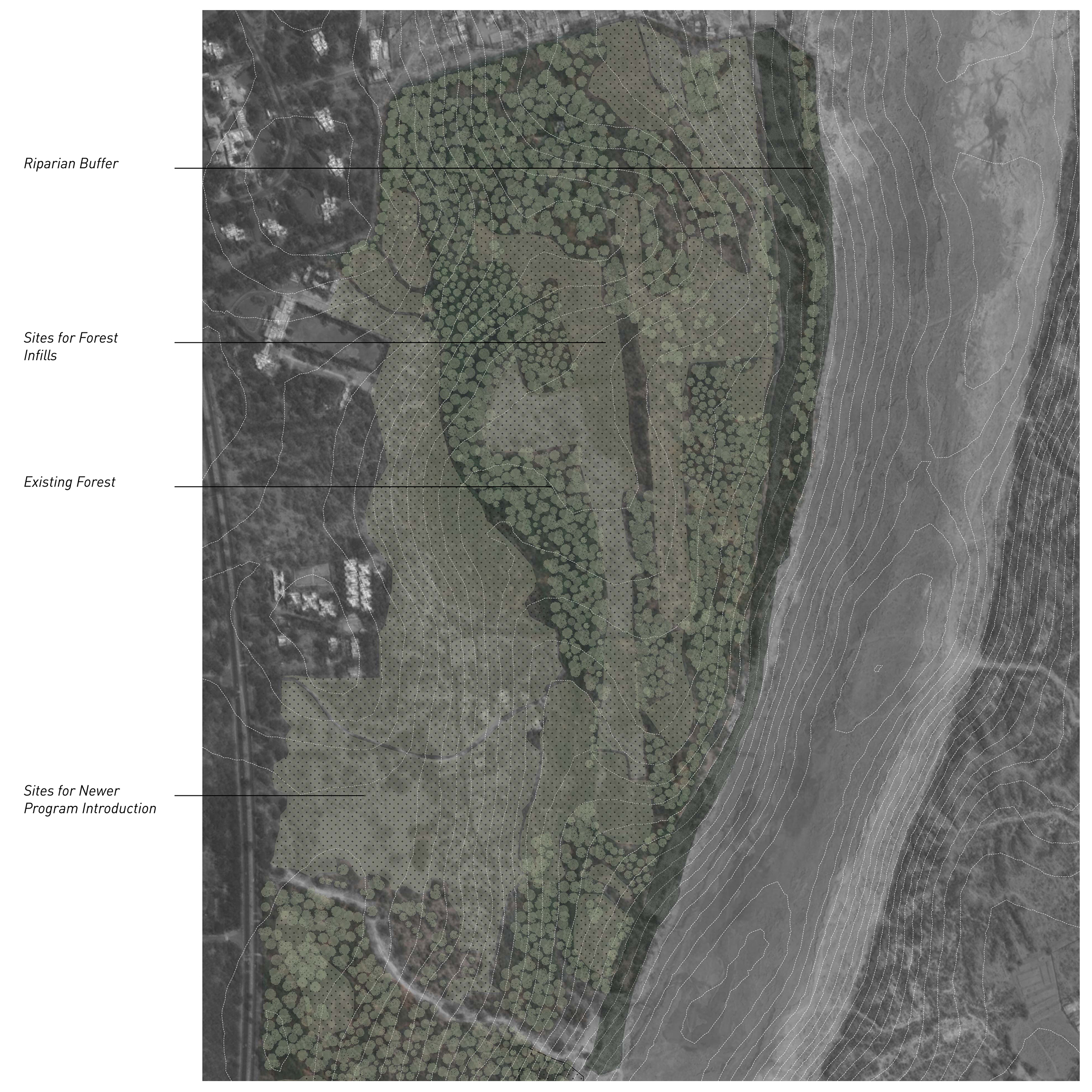
- 1. Historic Imagery: of the site as a tool to identify patches which need to be conserved.
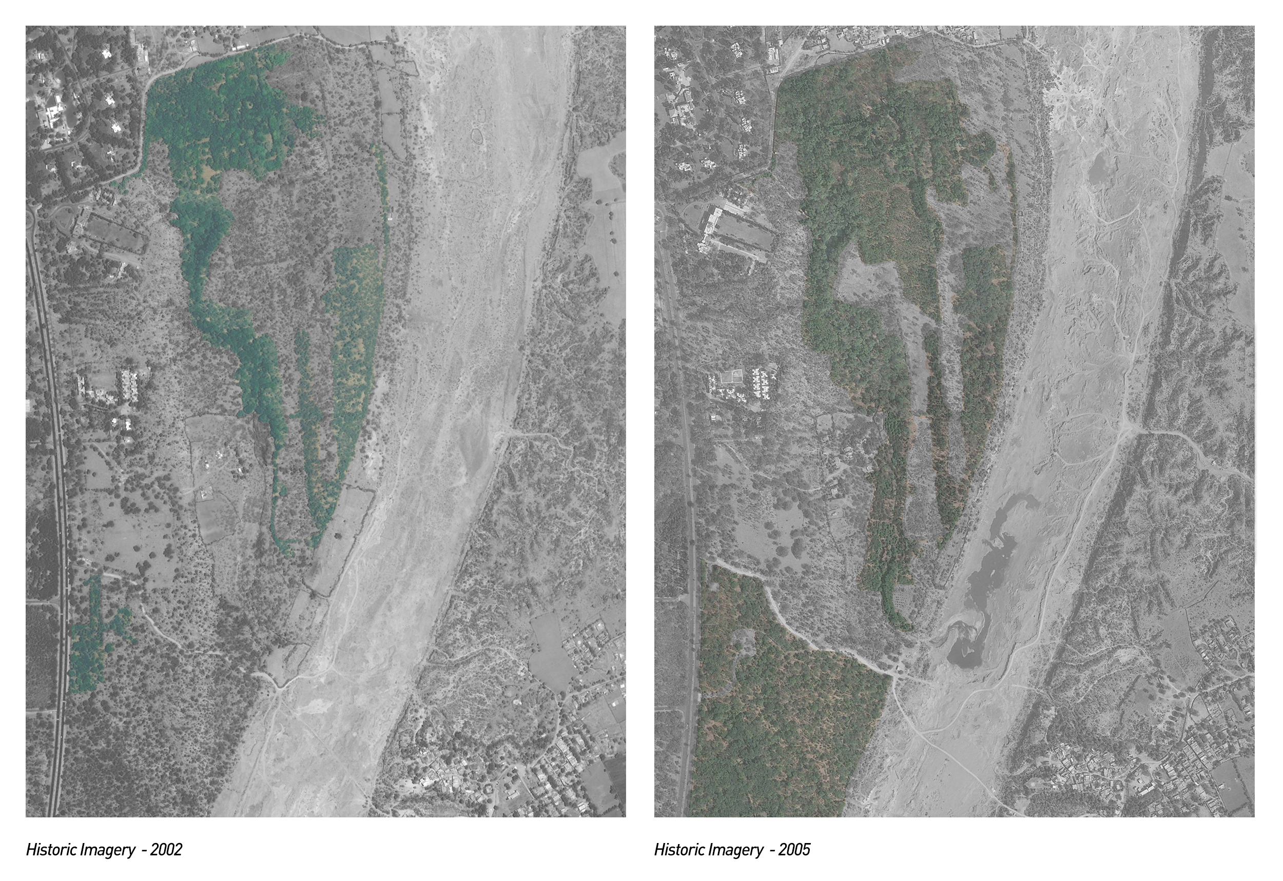
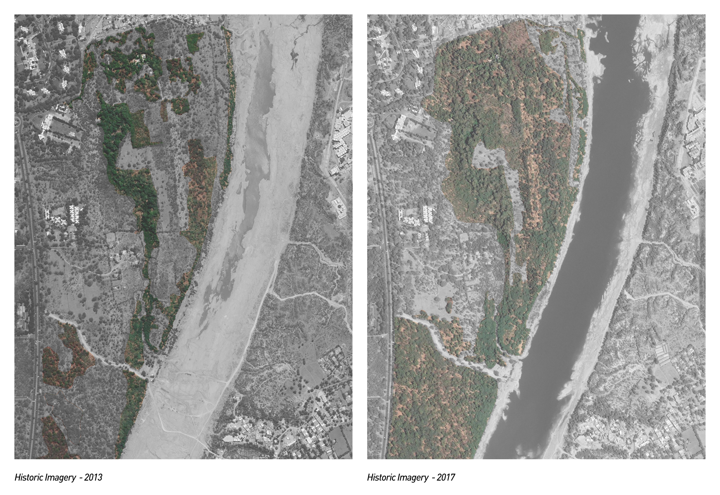
Through the Historic Images, holes on the existing site are identified, where the infills can be done.
2. Layering Topographic Information: The topographic information is used to further articulate the gaps that exist in the landscape, and create a speculative version of the primary infills that shall be done in order to weave the landscapes.
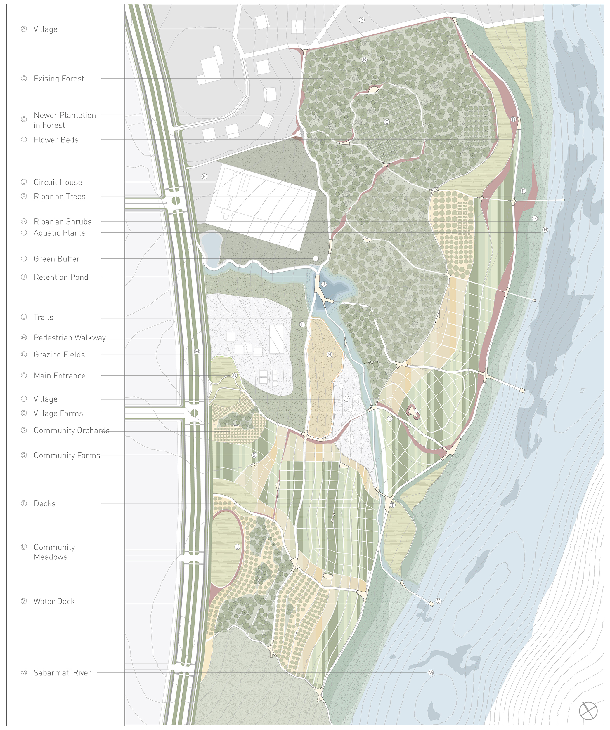
Design Proposal
This piece of information is further overlaid with the layers of;
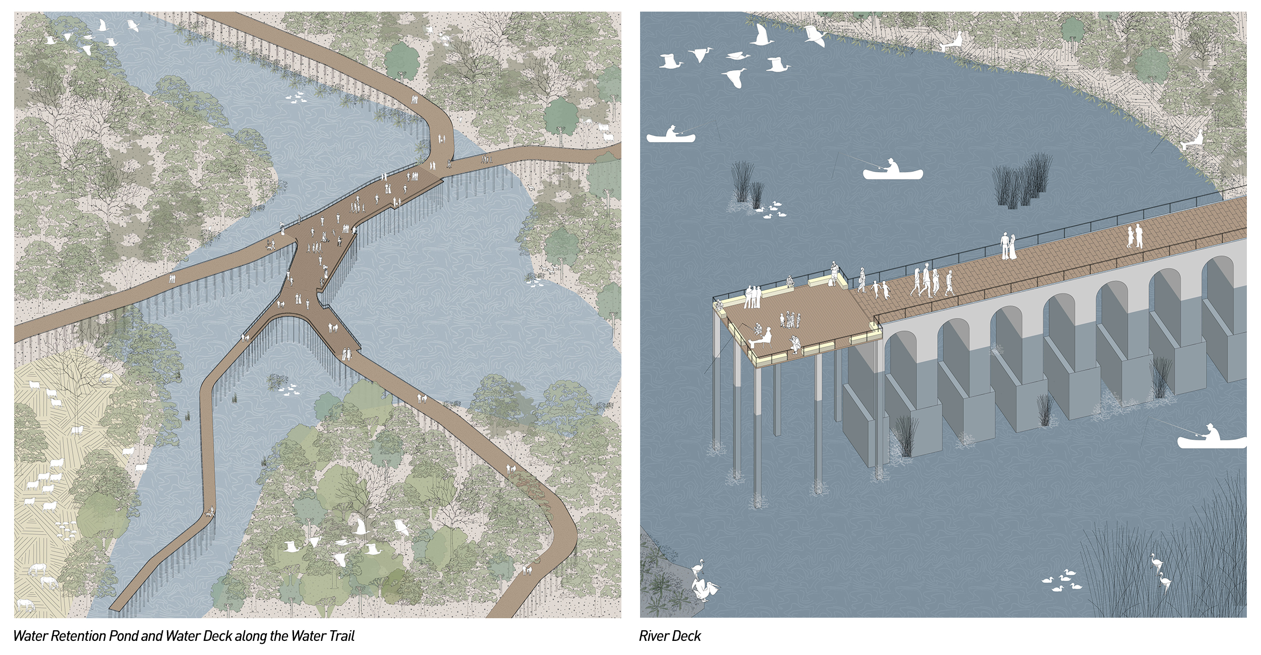
- Pedestrian and Cycle Trails: The thread that weaves the site to city is the non- motorized corridor. The corridor is further articulated on the site.
- Access to the Site: The trails ending towards the Jh Road become the main entry points to the site.
- The Jh Road: The crochet that comes together is between three layers, the riparian zone, the productive infills and the public edge. The Jh Road becomes the main public spine.
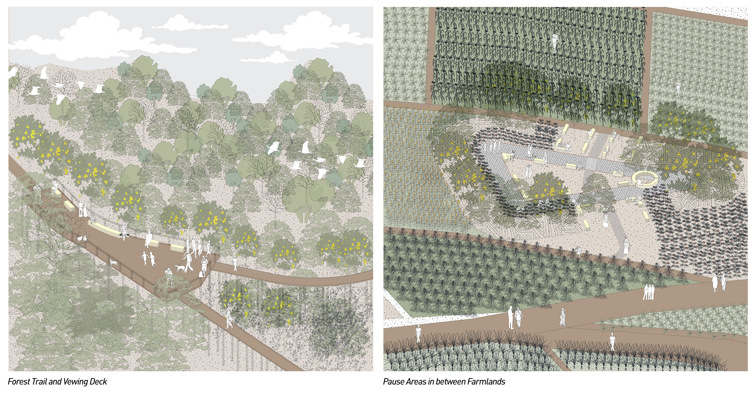
- Pause Areas: Pausing throughout the site is not just limited to physical pause and resting, but more or less pauses are an outcome of experiential break that is choreographed through combining different landscapes.
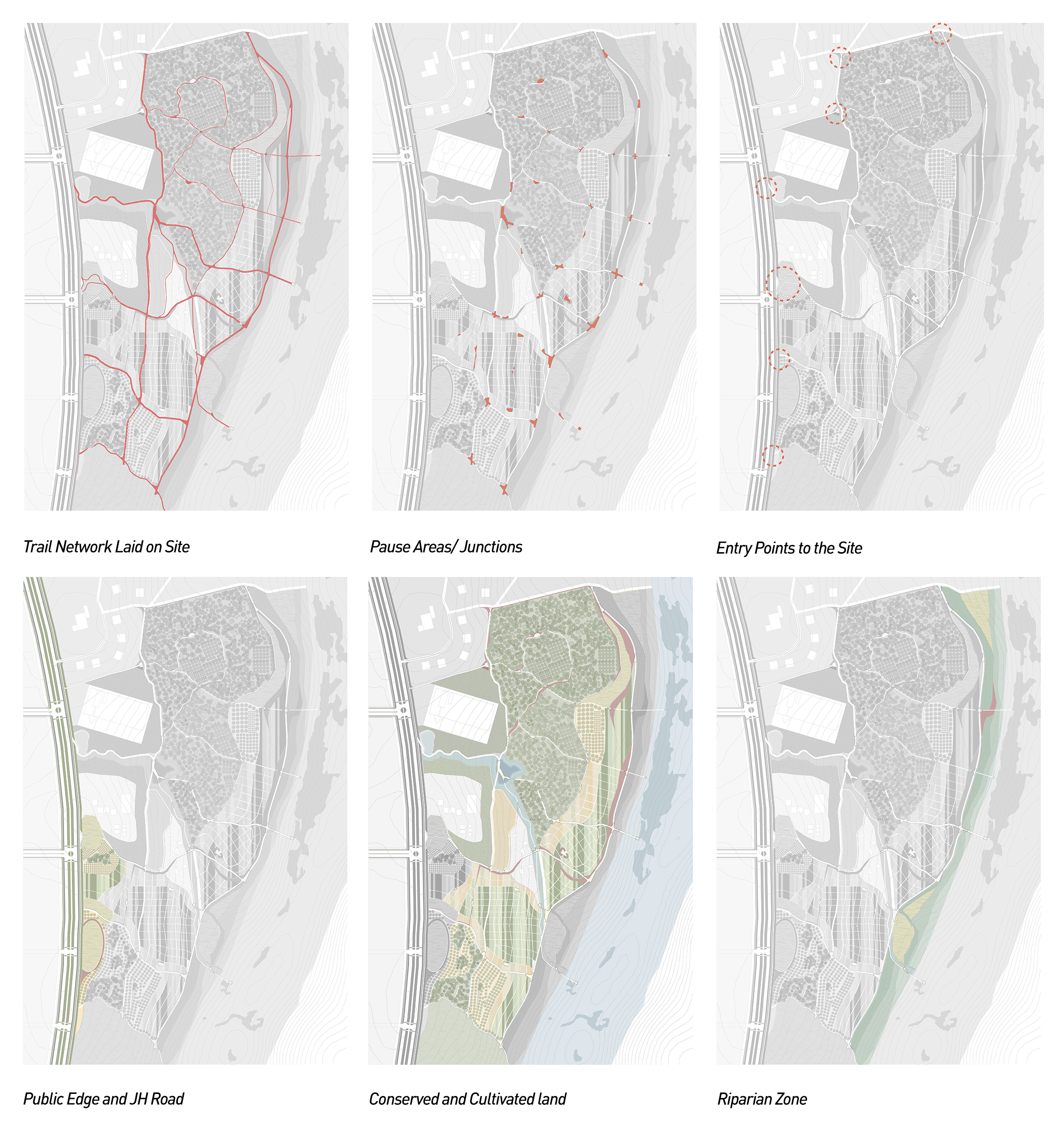
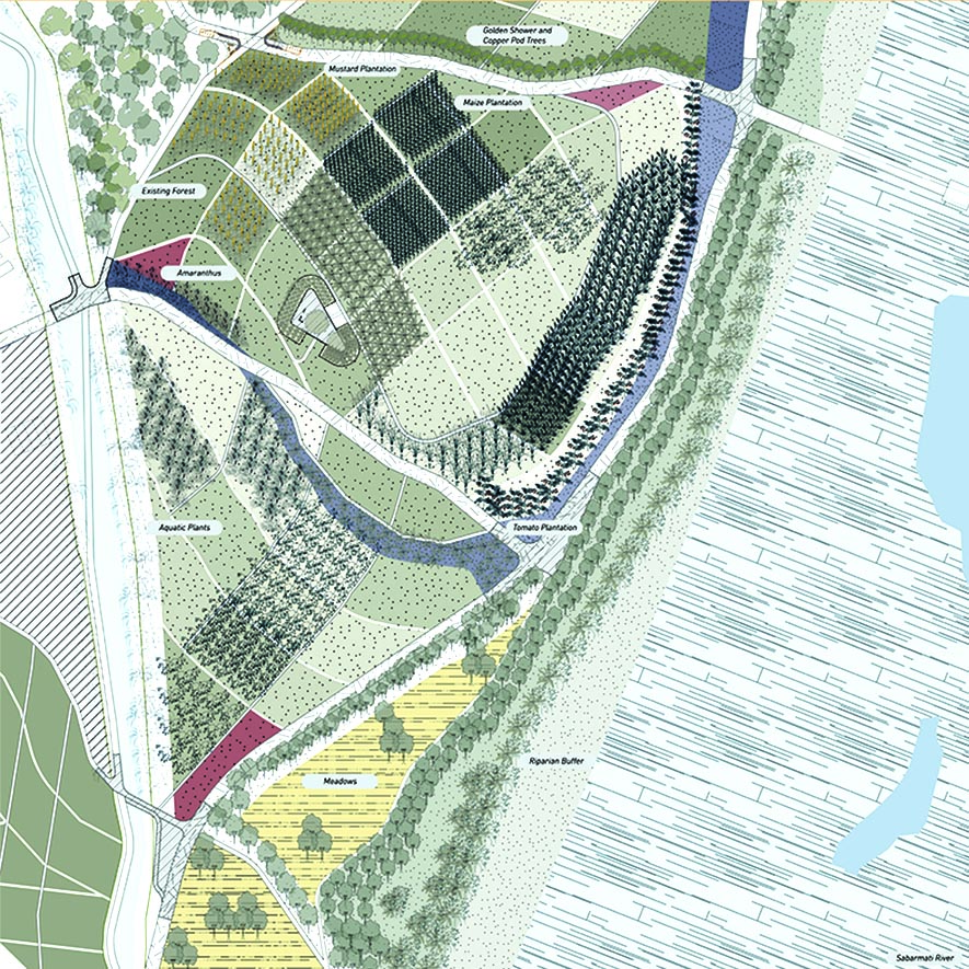
Demonstrating the Crochet ( Detailed Plan)
A smaller patch is selected from the site to show how different programs can be weaved together.

The plan depicts how different programs are infilled on the site. New programs are added on to site to create a diverse experience. The crochet aims to create a biodiverse landscape which caters to all kinds of inhabitants. The final outcome of the crochet is a weaved visual which provides a diverse experience. For example, some trails are lined with flowering trees where as other trails cut through the farmlands where various species are grown.
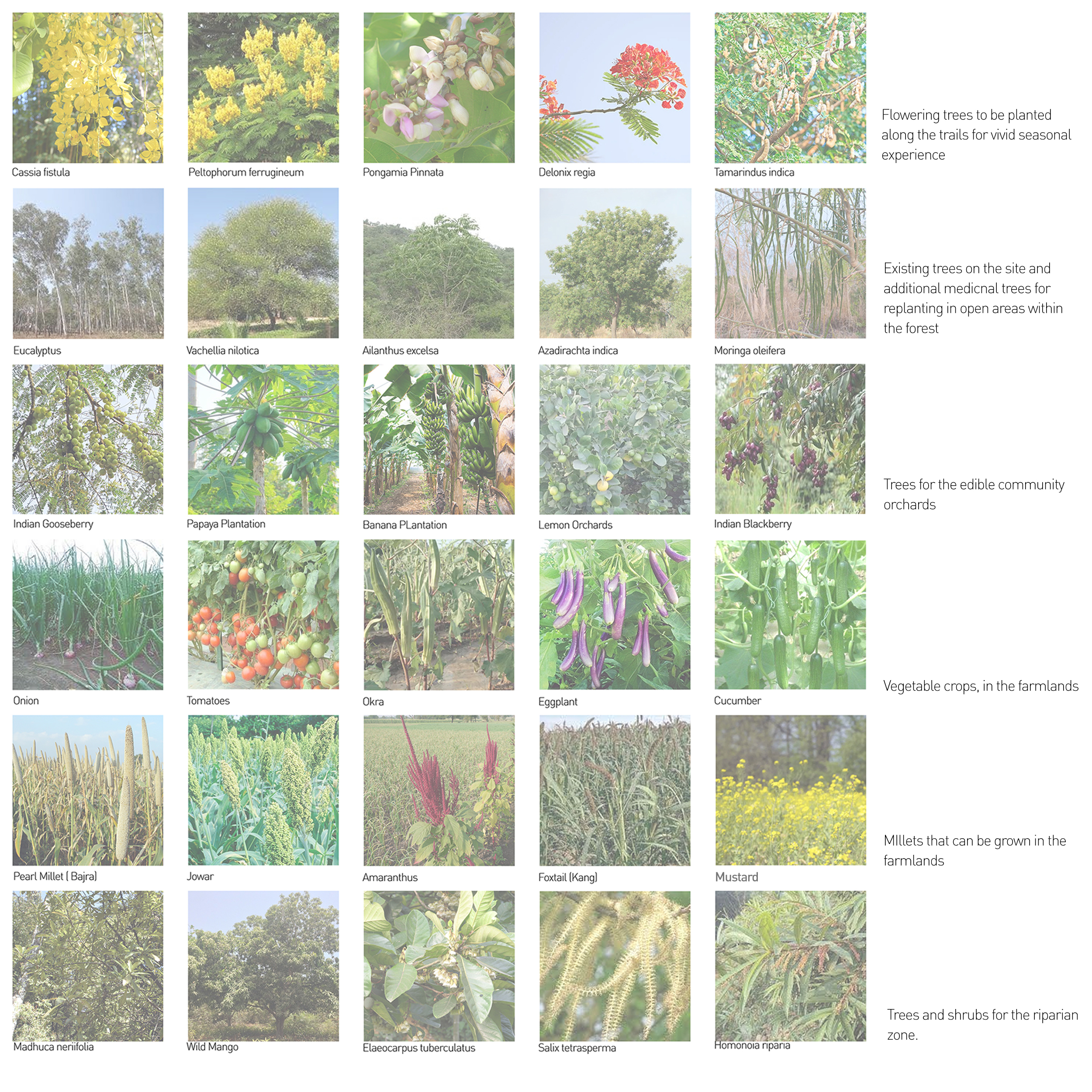
The catalogue below is a collection of some species which can be planted on according to the various programs that are identified on the site scale plan.
Views of the Crochet River Side