

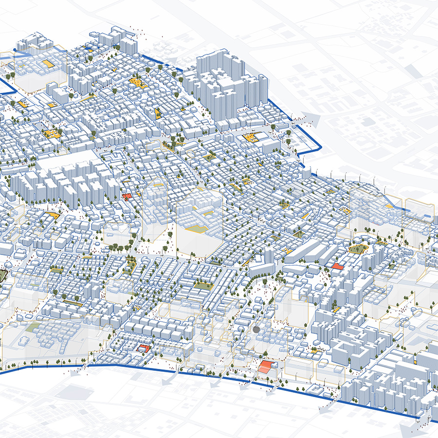
This work by Unit 6 students presents a multi-scalar study of Urban Open Spaces in Ahmedabad, examining how open space is distributed, allocated, implemented, and experienced across three levels – City, Town Planning Scheme (TPS), and Plot. Beginning with field mapping of 156 precincts (1 sq. km) and selection of 16 representative precincts, the study identifies a critical mismatch between overall open land and publicly accessible recreational open space.
At the city scale, GIS mapping and service-area analysis reveal an extremely low provision of public open space—~0.5 sqm per person—along with unequal distribution across East and West Ahmedabad. At the TPS scale, the work evaluates proposed versus implemented open spaces across selected schemes, highlighting gaps between reservation and delivery, and the resulting impacts on proximity, density, and surface temperature. At the plot scale, the study examines Common Open Plots (COPs) within private developments and finds that while COPs hold potential as meaningful green/social spaces, many are underutilised or converted to parking and residual uses.
By reading the city through these interlinked layers of governance and ground realities, the work frames open space not only as a design concern, but as a structural and policy question—one tied to equity, thermal comfort, and ecological resilience. It concludes with recommendations for stronger classification, implementation, and ecological integration of open spaces, including protection of wetlands, riparian edges, and low-lying buffers as essential urban systems.

