The three corridors
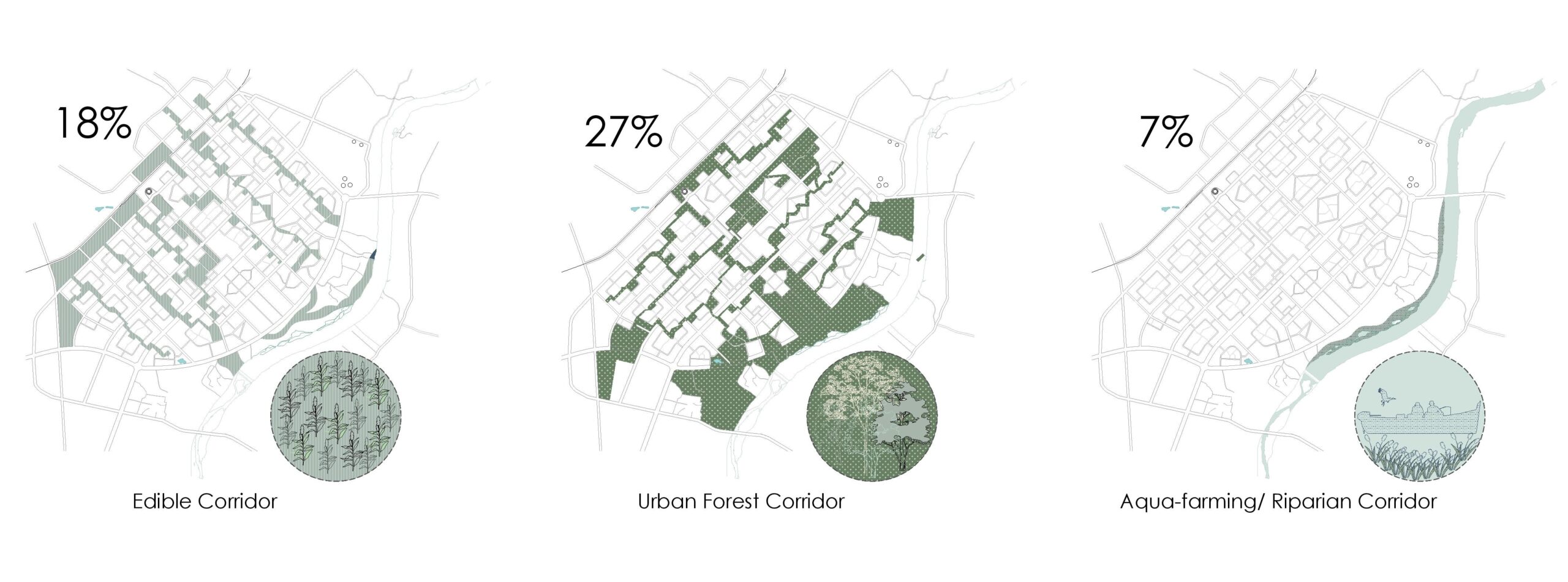
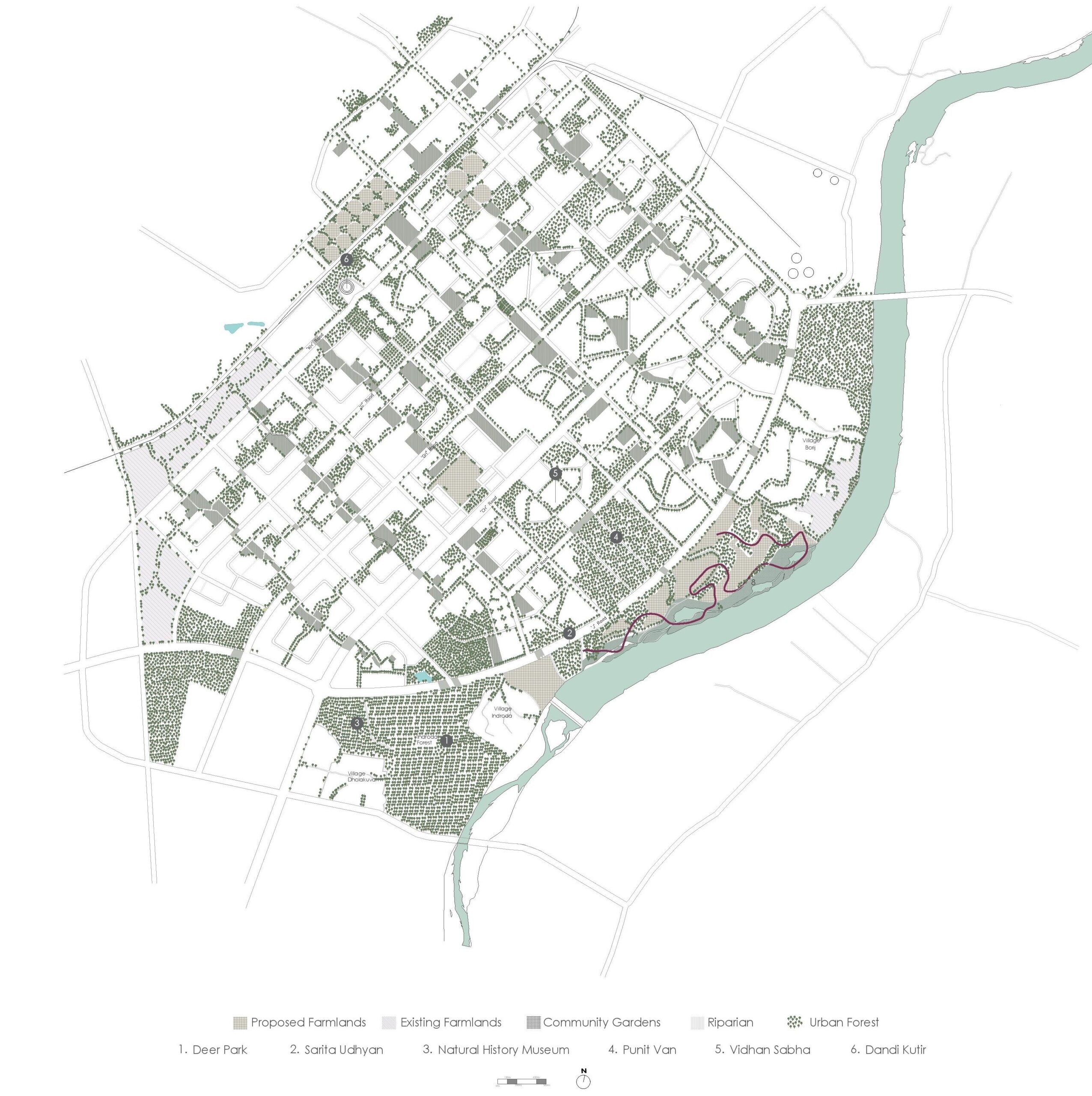
The project constitutes of three corridors namely, Edible Corridor, Urban Forest Corridor and Aquafarming /Riparian Corridor
Catalogue
The corridors are an integration of 4 major landscapes present throughout the city.

The River Edge
Site Introduction
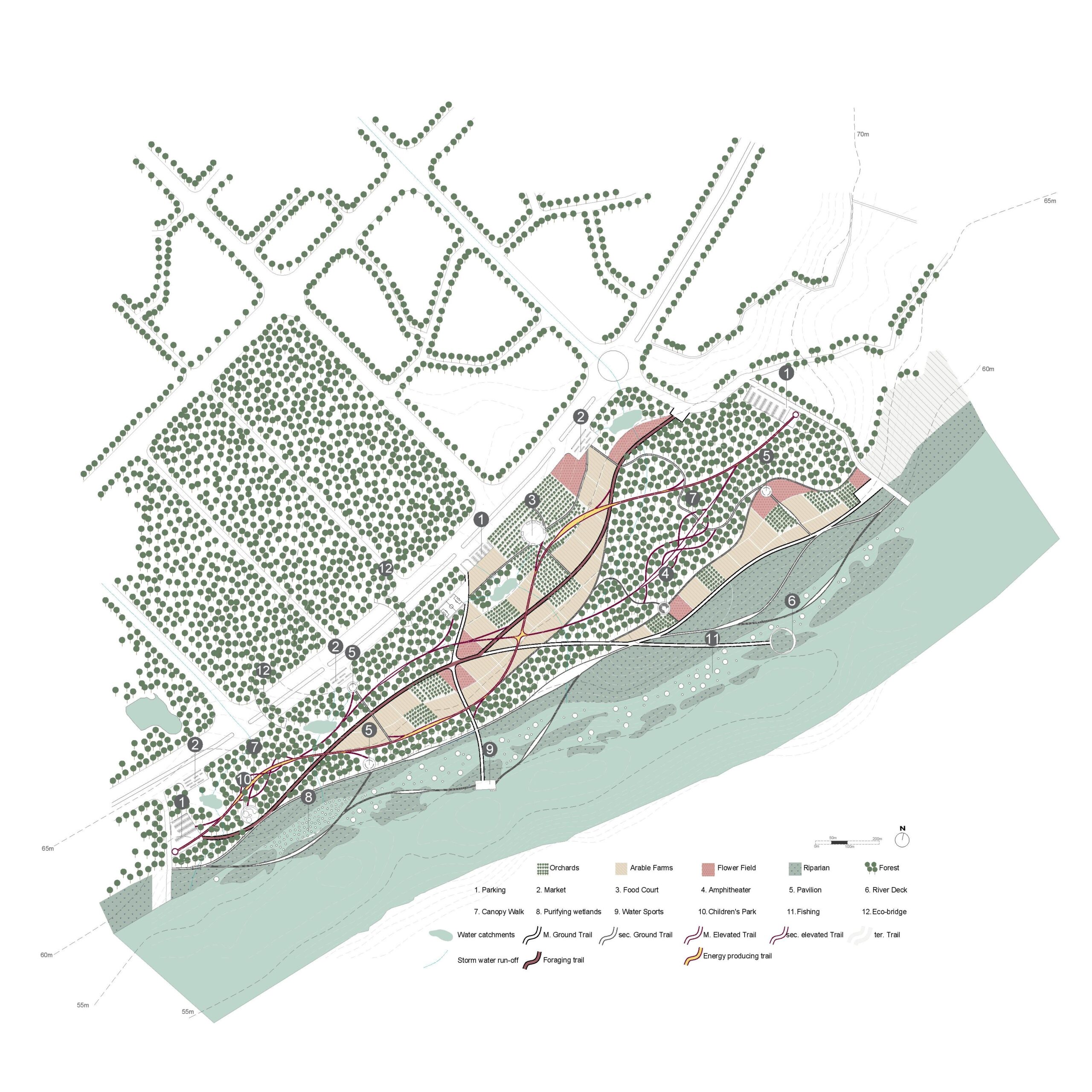
The 3 corridors converge at the river side. The site is envisioned as an urban park, with a range of productive activities. At present the site consists of a prominent tree cover. The next step was identification of the perennial vegetation over the years with the help of google earth and preserving it as a part of the urban forest corridor. The remaining land can then be converted for the use of farming and the riparian corridor.
The Park
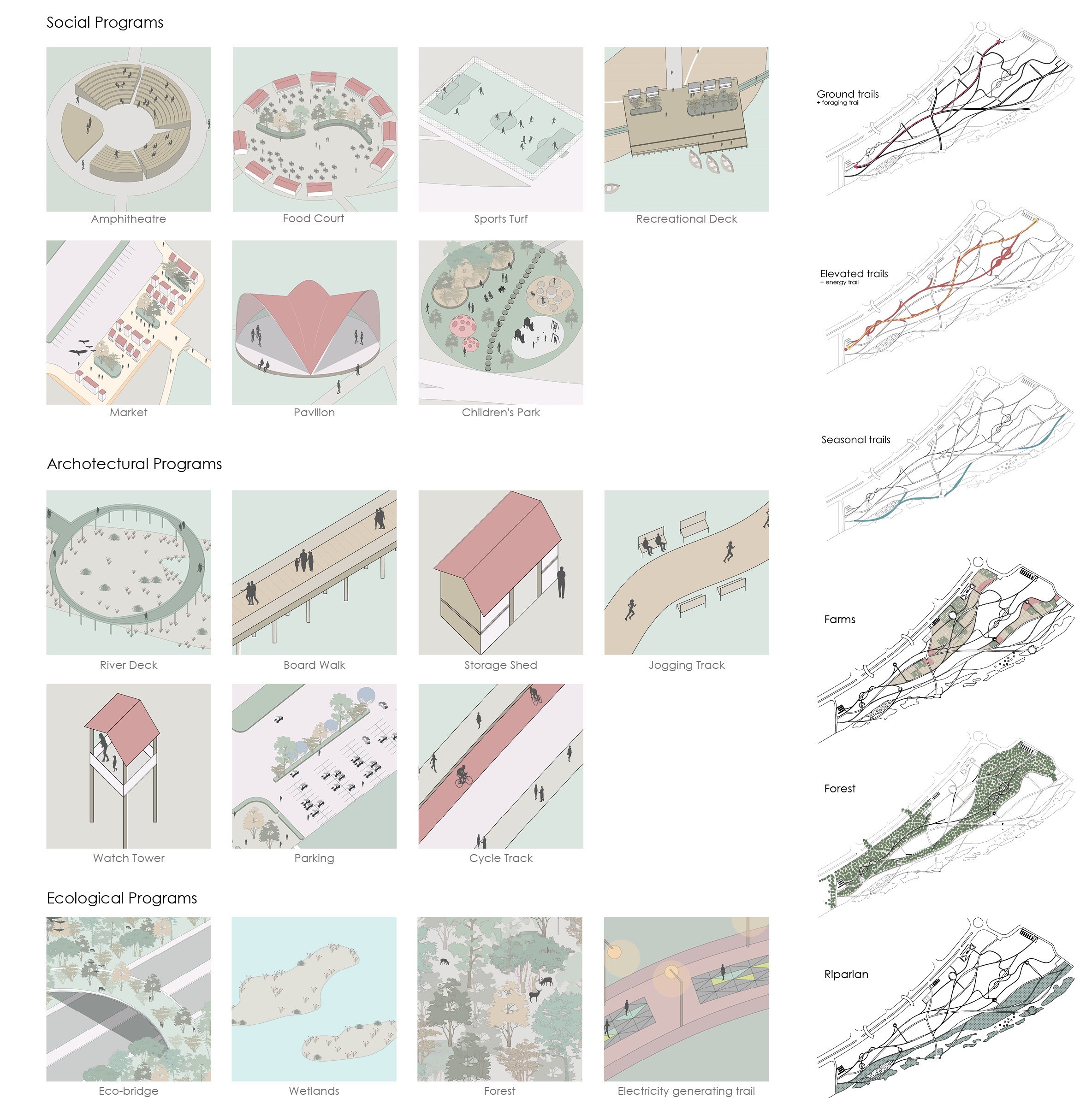
For minimal intervention, the park is designed as a network of trails with integrated programs that act as activators. The trails are of 3 kinds: ground trails, elevated trails and seasonal trails. The program palette for the site is chosen keeping in mind the activation required for making the park a lively place. The social programs intend to attract people to the site and architecture programs act as supplementary infrastructure to support the activities where as ecological programs aim at enhancement of the ecology along with promoting sustainability.
Dynamic Experiences
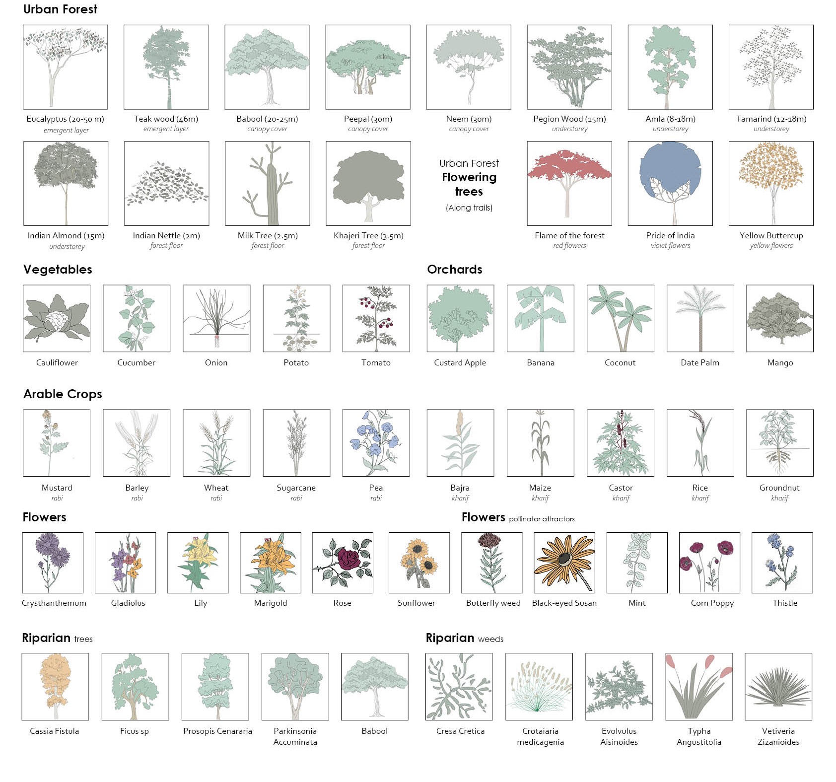
The planting palette is chosen keeping in mind the experiential quality of the trails and the landscapes that people will walk through. The colors, height variation and the diversity of the species chosen will ensure the diversity in experiences while exploring the site.
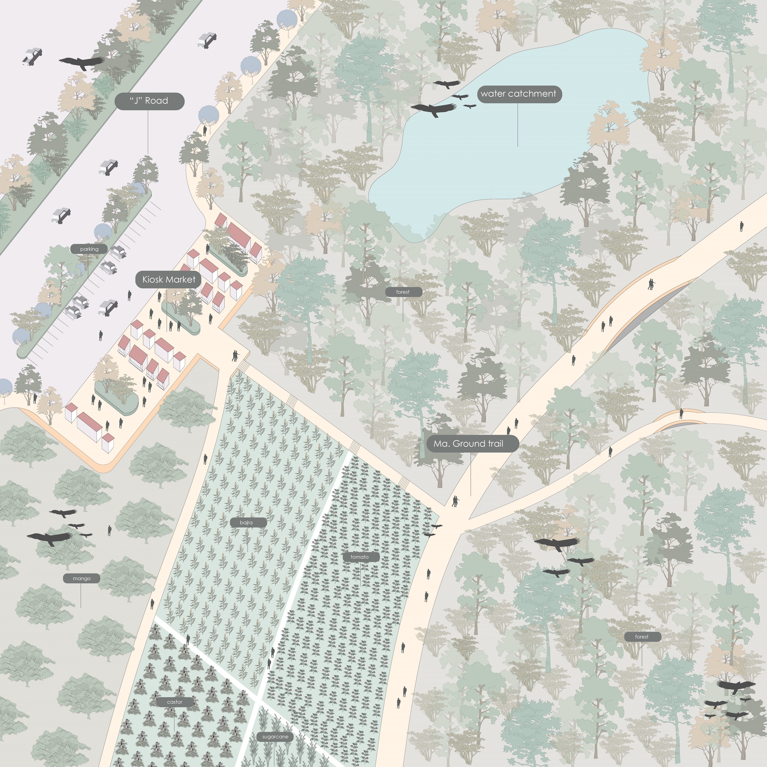
Activating the J Road
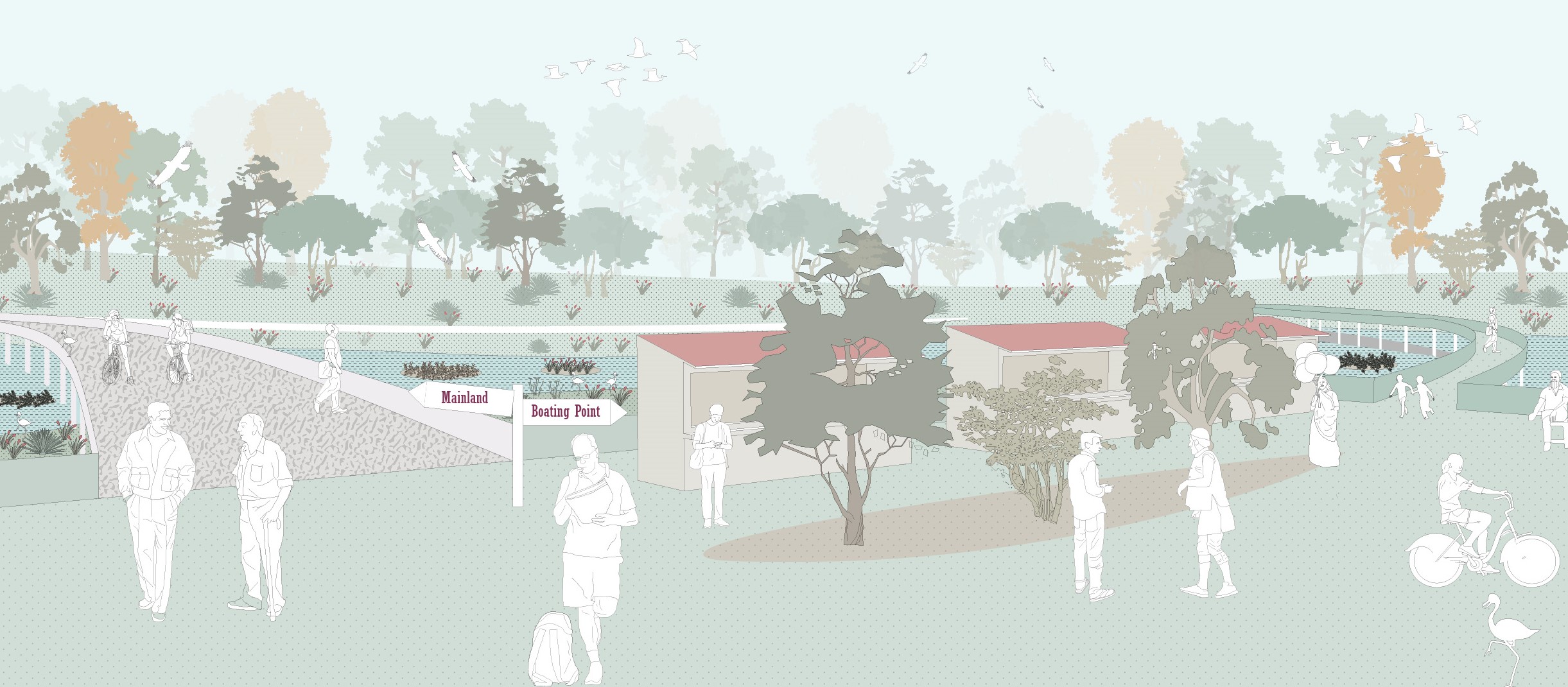
The kiosk markets help to activate the J road along with opening up a part of the site to the city. The market sits at the edge of the edible corridors and provides the users with a diversity of experiences with changes in the seasons. The water catchments present throughout the site help in storage of storm water from the city and rain water for irrigation of the farms.
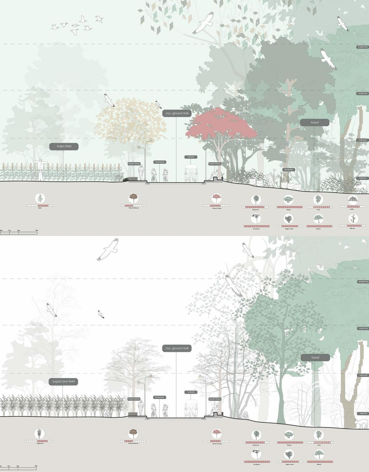
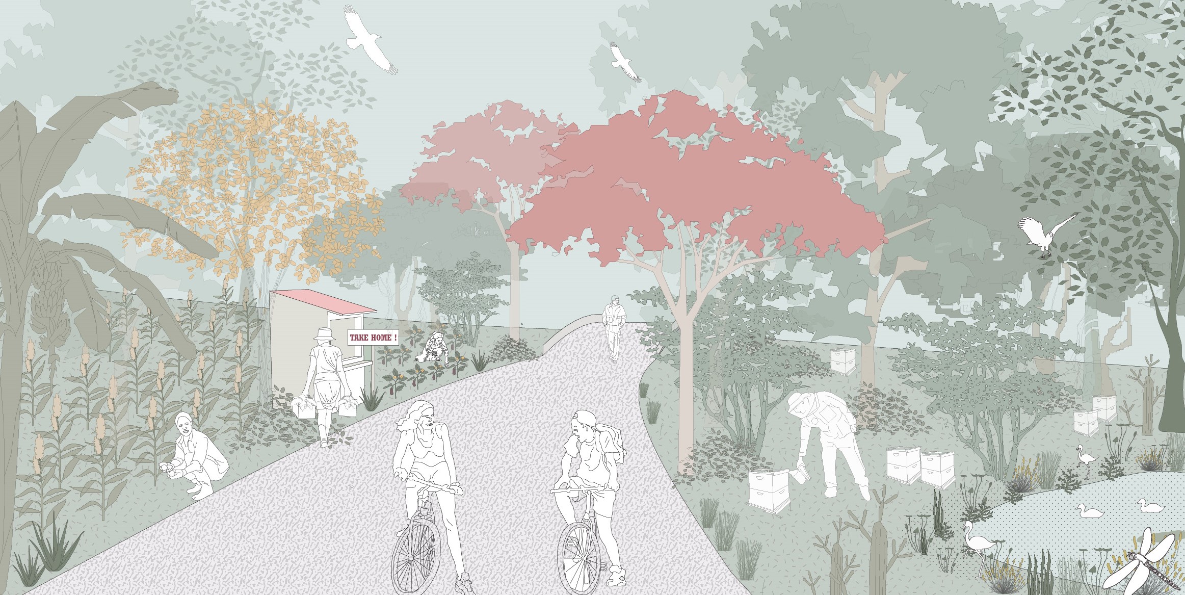
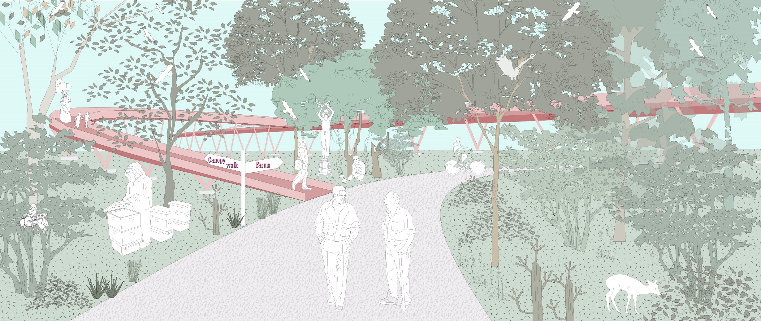
The ground trails provide connectivity and ease of mobility across site. The foraging trail is a part of the ground trail network, where people can forage and take the produce home with them.
Into the canopy!
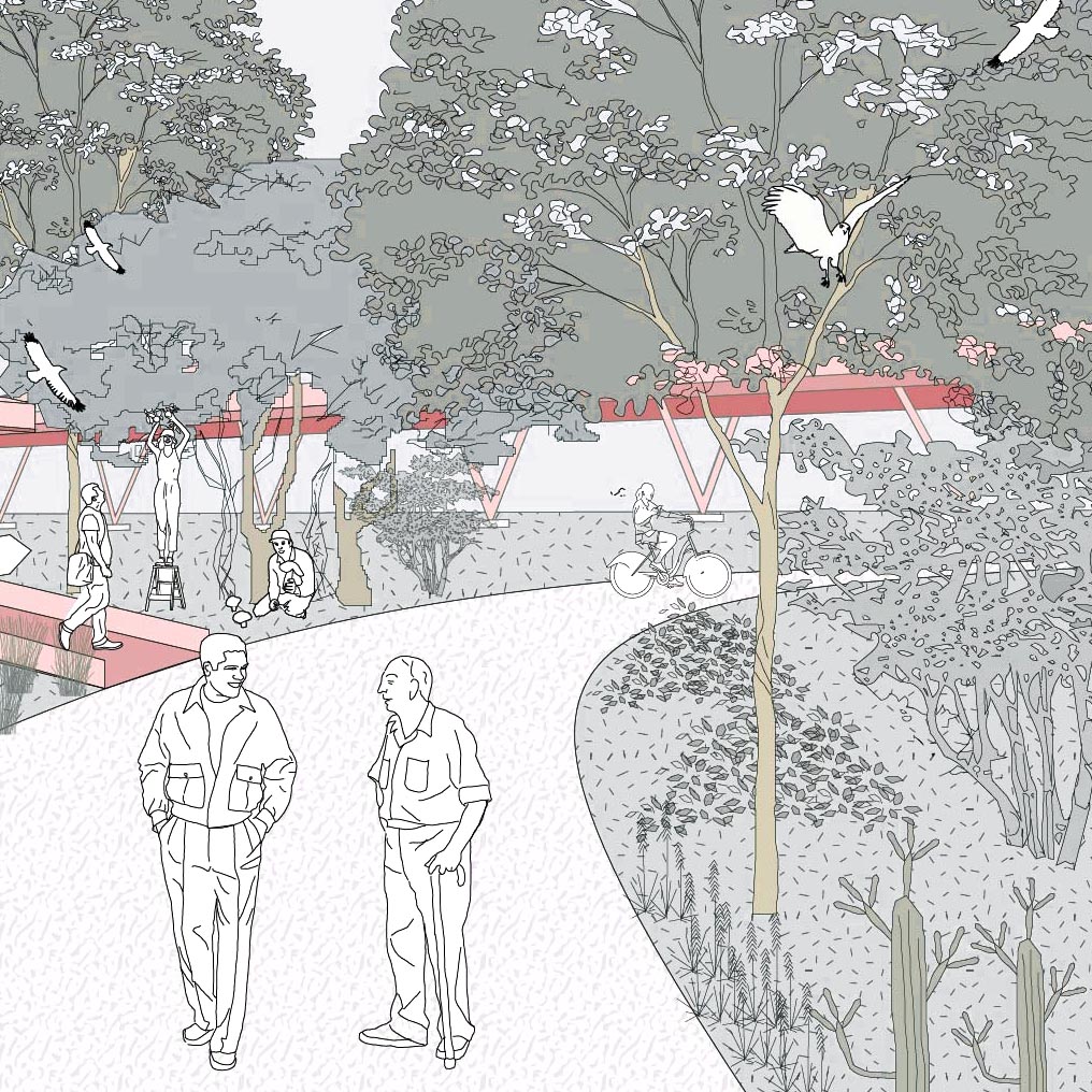
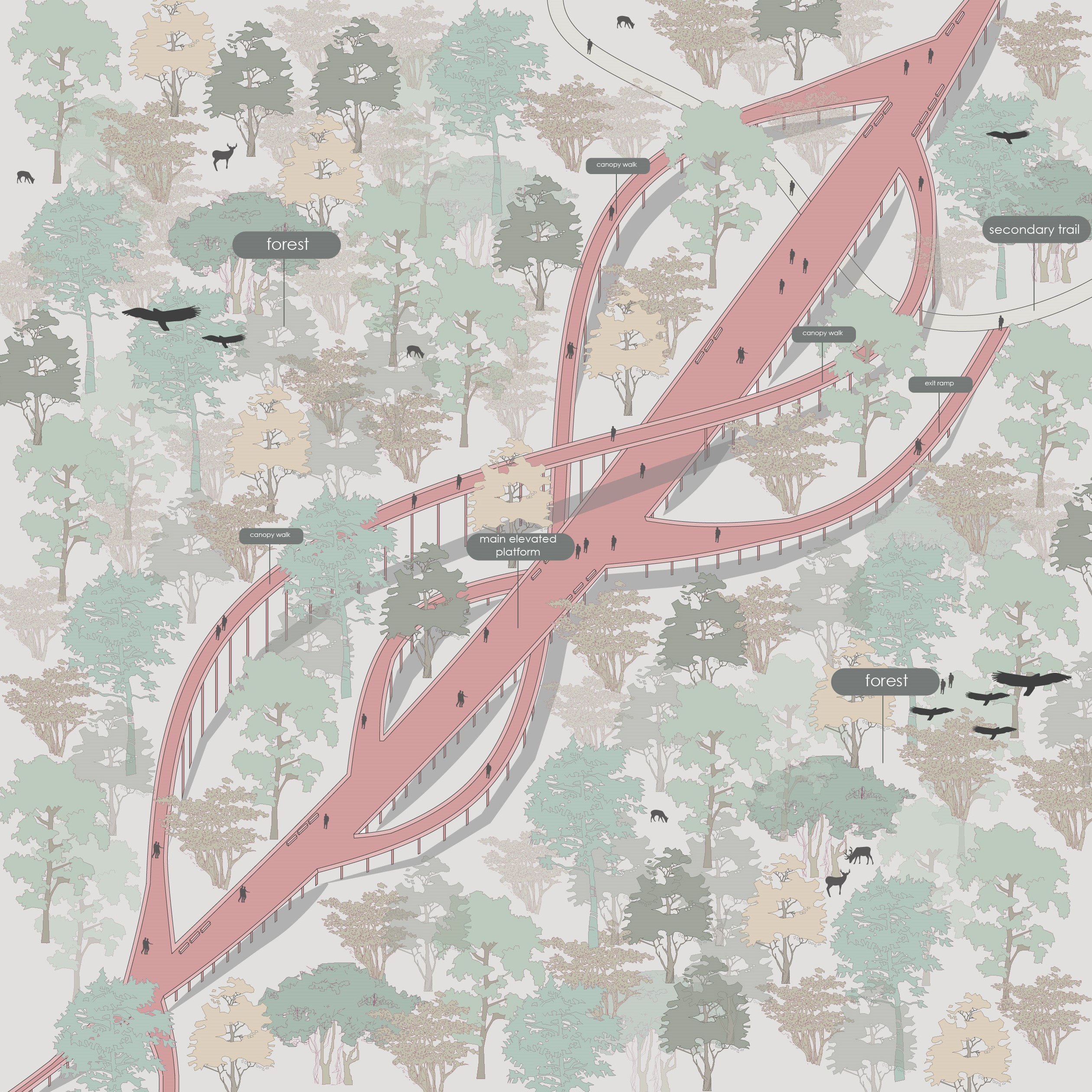
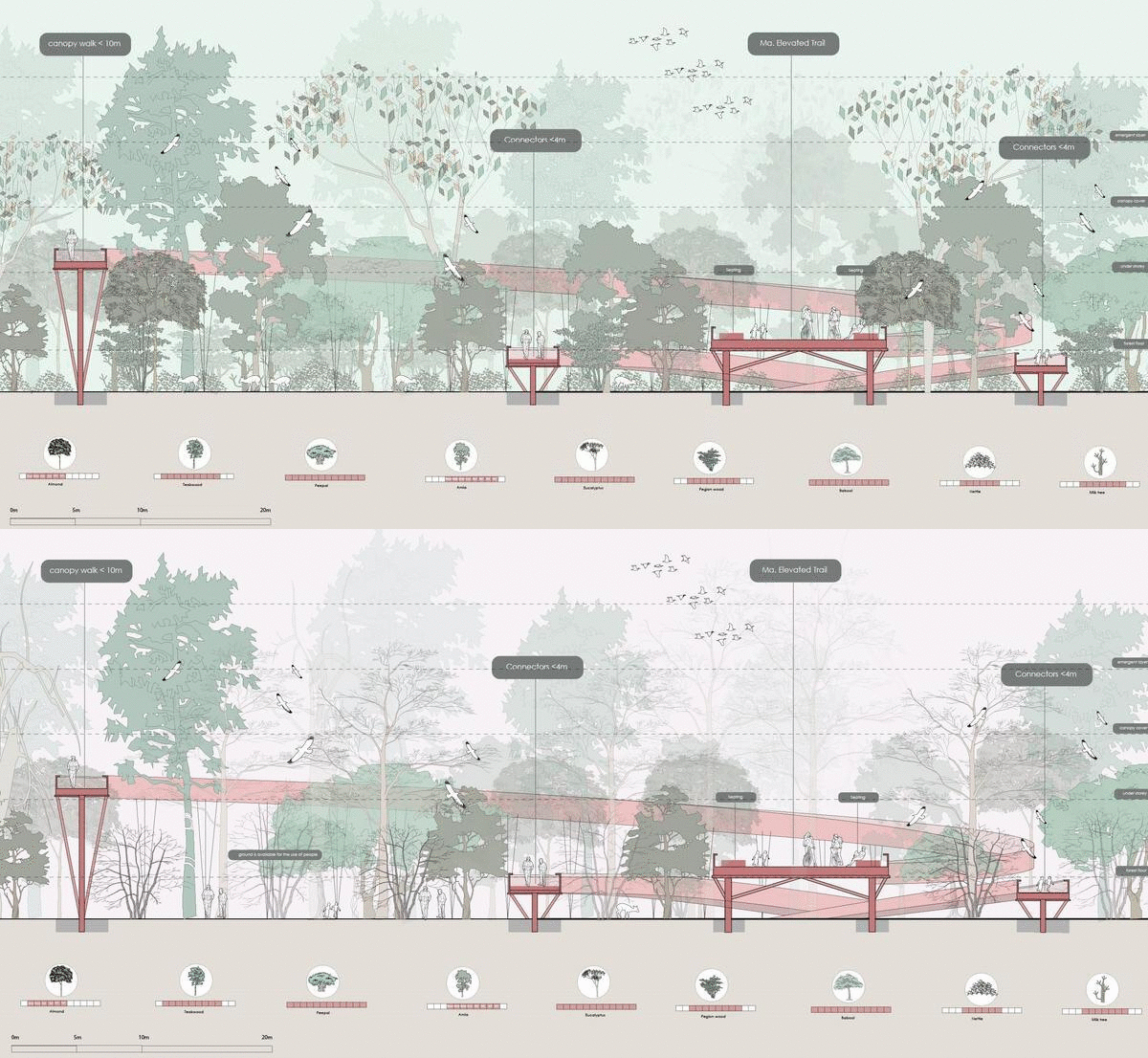
The Elevated trails act as connectors to different programs on the site and form a network of paths at level above the ground, through which people can explore different landscapes on the site. This forms a network of trails that take you through different parts of the urban forest corridor and right up into the tree canopies.
The forest also shows a dynamic character when transitions in the seasons, during monsoons the forest floor becomes inacccessible due to wild growth of species like Indian nettle and during the winter season the forest becomes less dense and the ground can then be accessed by the people.
Connecting to the river
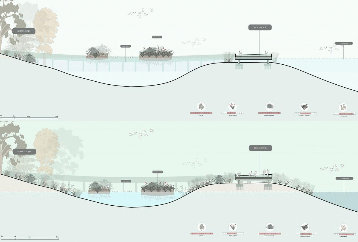
The riparian corridor consists of riparian edge and wetlands, and they are connected to each other and the mainland through a network of board walks which maybe submerged during the monsoon season. The wetlands help in flood management and prevention and boardwalks connect the wetlands to the mainland bringing people closer to the river with certain activator present at the nodes.

