preloader
Scroll to top
Understanding the City - 2025

The Impervious City: Private Open Spaces Between Paving, Underuse and Urban Potential

  • Tags

    Ahmedabad, Cept University, Urban Heat island, Private open spaces, GDCR, Impermeability of Ahmedabad

Understanding the City_UTC 2026
Part of Foundation Studio for Masters in Planning

Tutors: Mansi Shah | Teaching Associate: Arathy S.

Students: Aiswairya A, Sakshi Dhawaliker, Dayita Gupta, Shriya Gupta, Jayesh Iyer, Sakshi Jaju, Falguni Mehta, Kshitij Parashar, Sanyukta Patil, Sudhanshu Patra, Khanak Sharma, Shruti Singh, Jeet Thakkar, Riddhi Tikkas

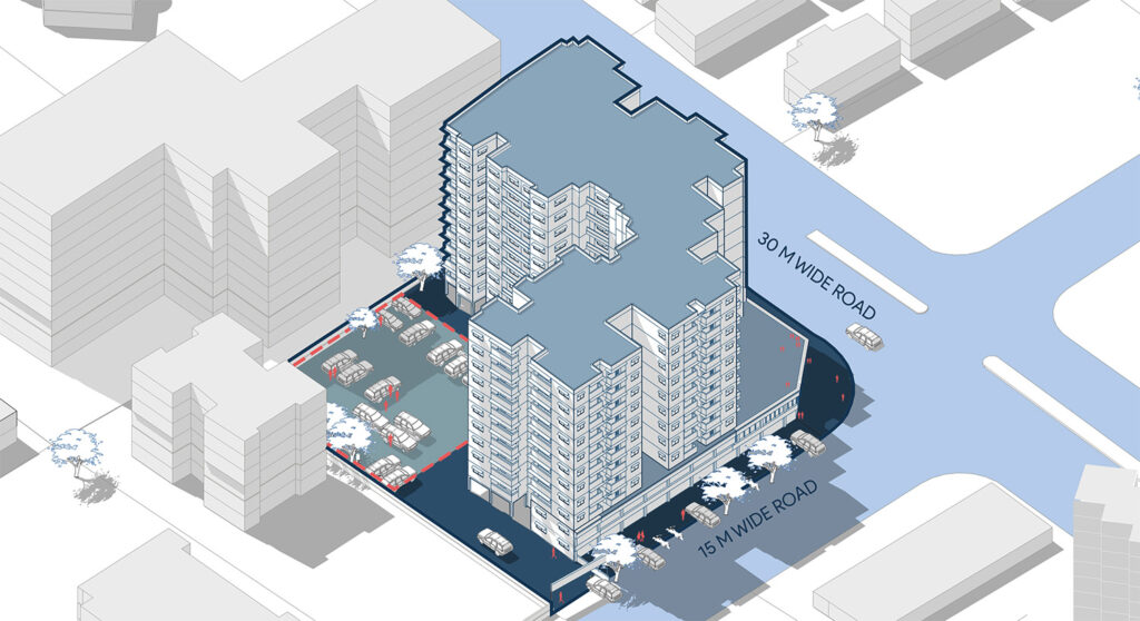
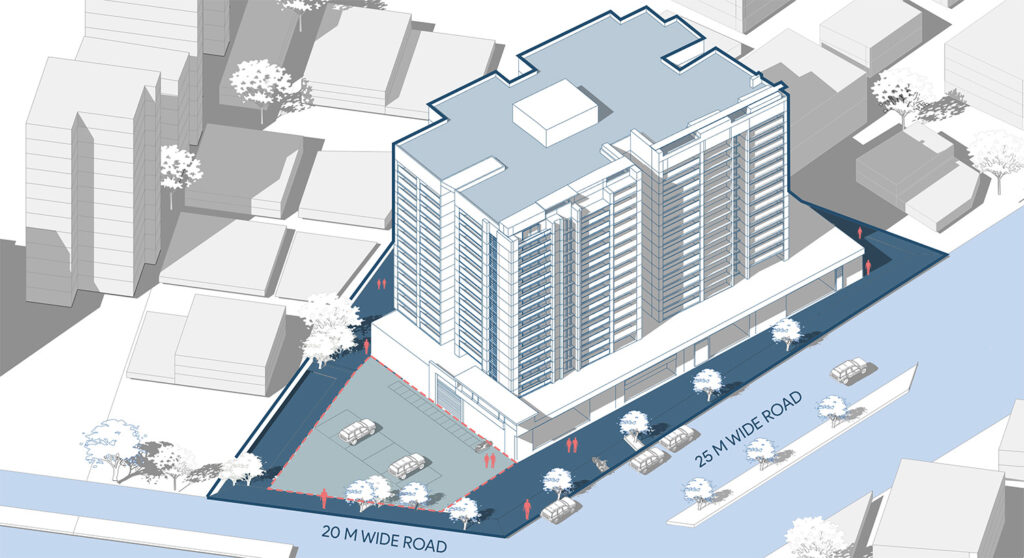
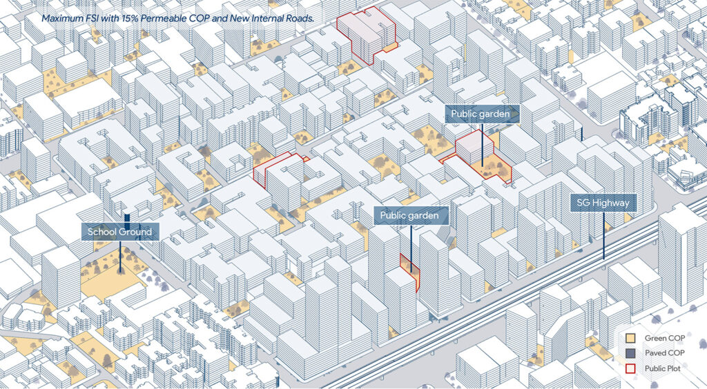
As Ahmedabad grows denser, private open spaces occupy a significant share of the urban fabric, yet their environmental and social potential often remains unrealised. This study examines how GDCR regulations shape these spaces and how they function on the ground. Through regulatory analysis, plot-level observations, precinct mapping and thermal assessment across nine precincts, we investigate the gap between the provision of open space and its actual performance. The findings reveal how spaces mandated as open areas frequently become paved surfaces, parking lots and residual margins, contributing to increasing urban impermeability. The study questions whether current regulations are achieving their intended purpose and explores how private open spaces could be reimagined as meaningful, connected and environmentally functional parts of the city.

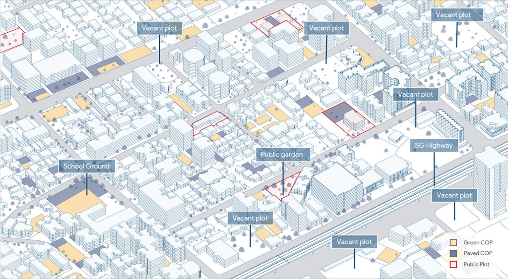
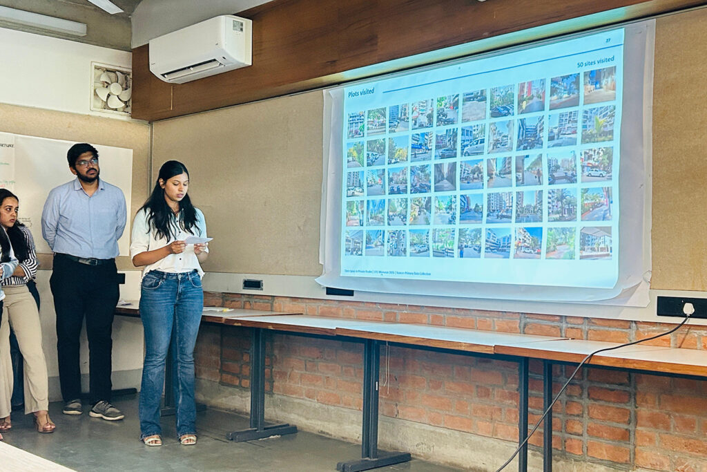
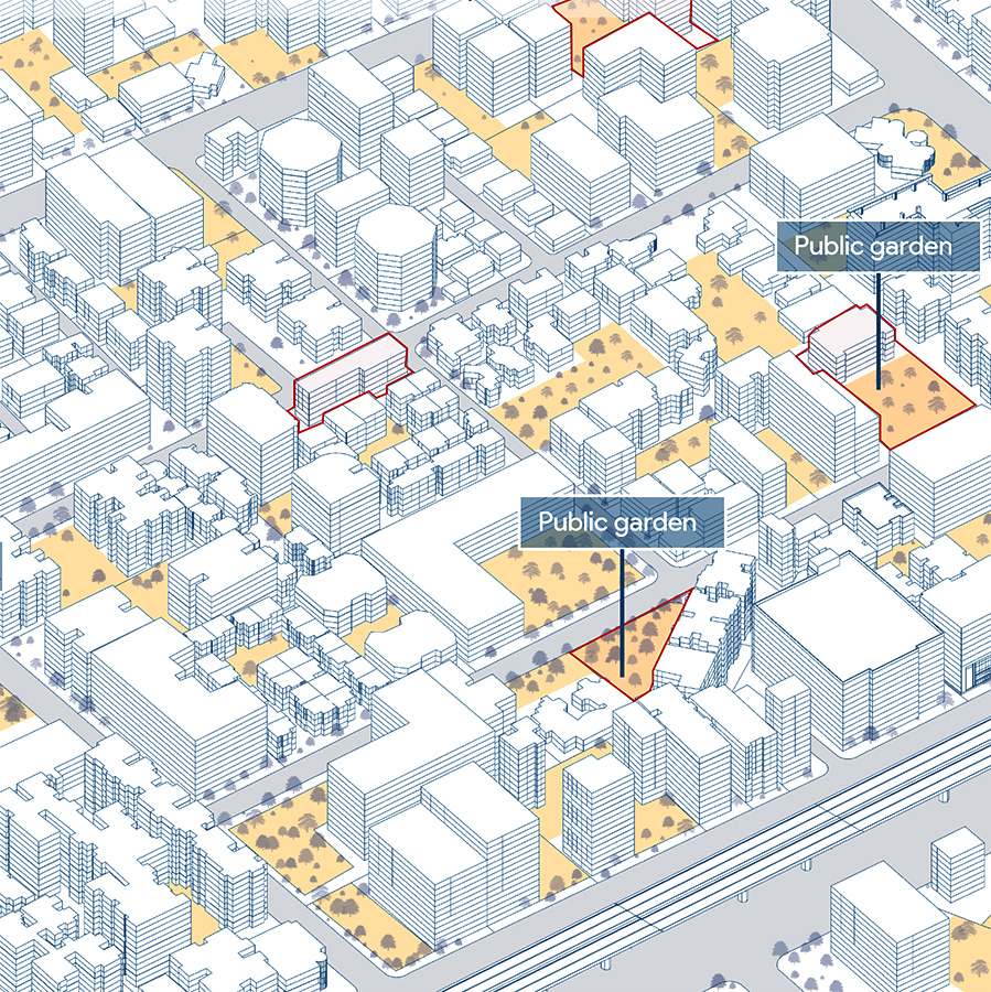
As Ahmedabad grows denser, private open spaces occupy a significant share of the urban fabric, yet their environmental and social potential often remains unrealised. This study examines how GDCR regulations shape these spaces and how they function on the ground. Through regulatory analysis, plot-level observations and precinct mapping across nine areas of the city, we investigate the gap between the provision of open space and its actual performance.

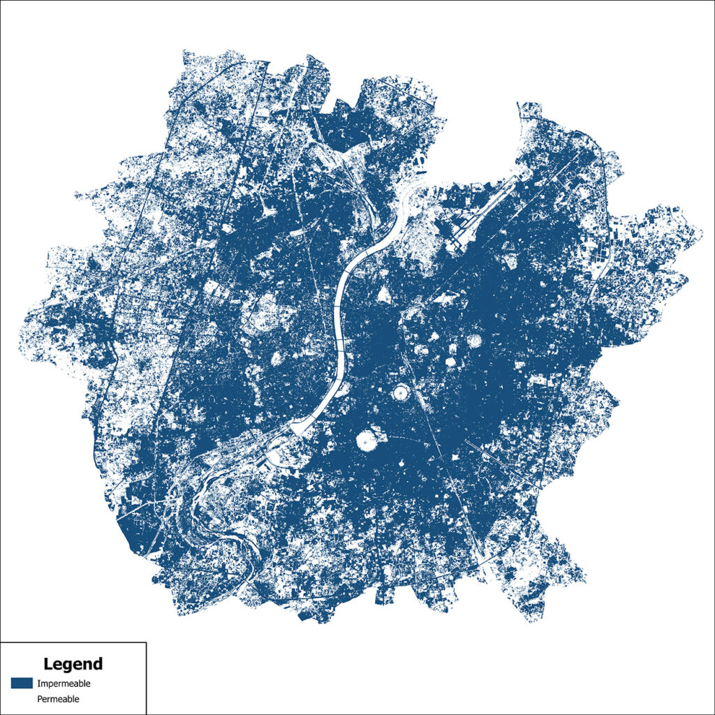
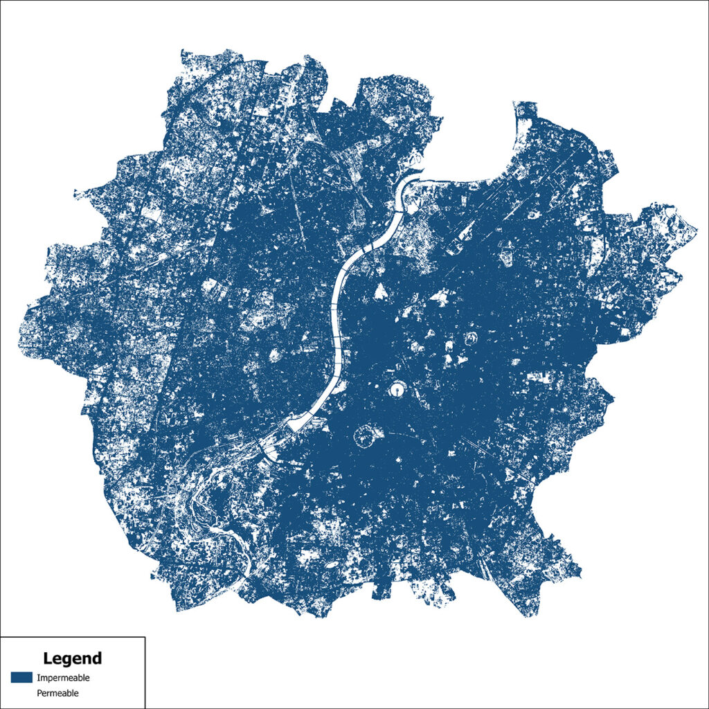
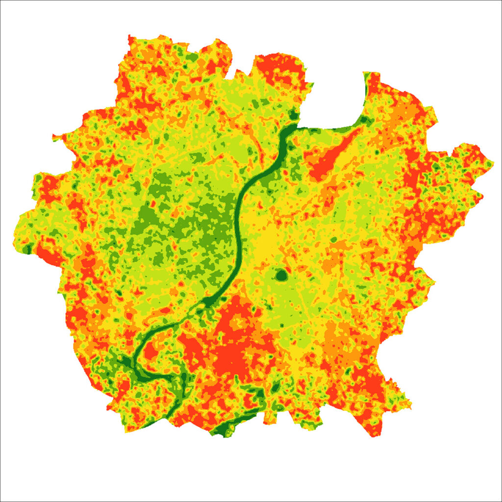
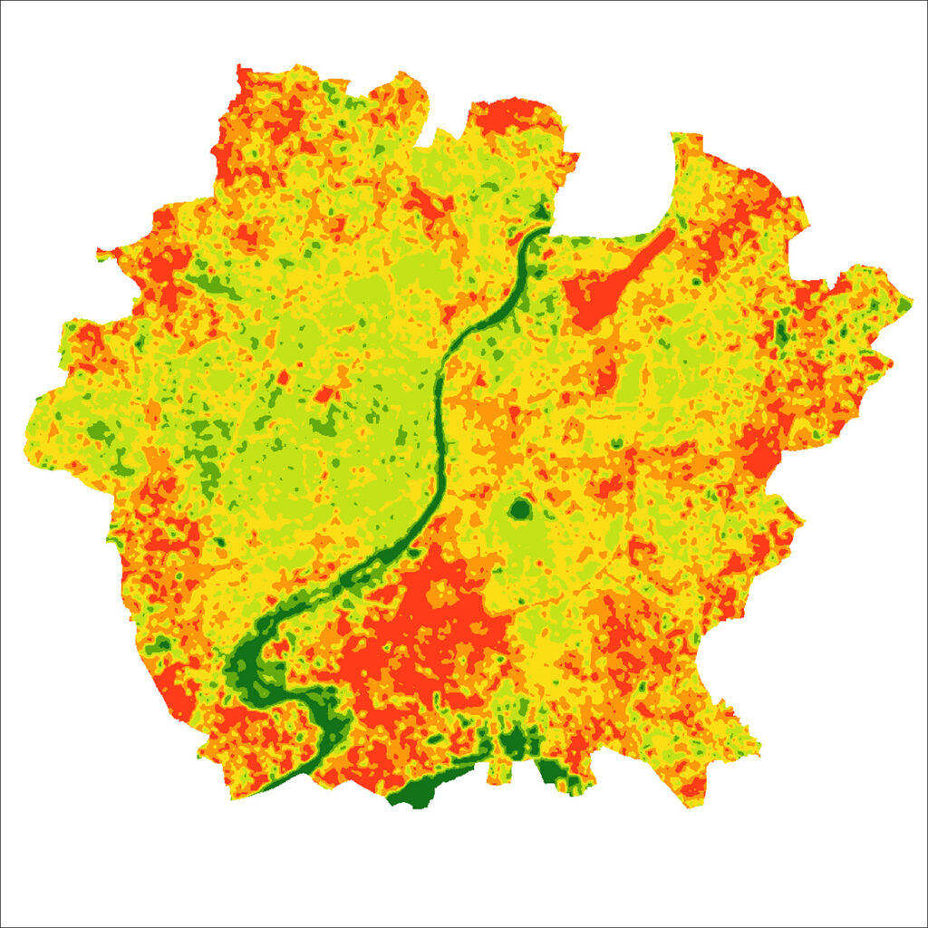
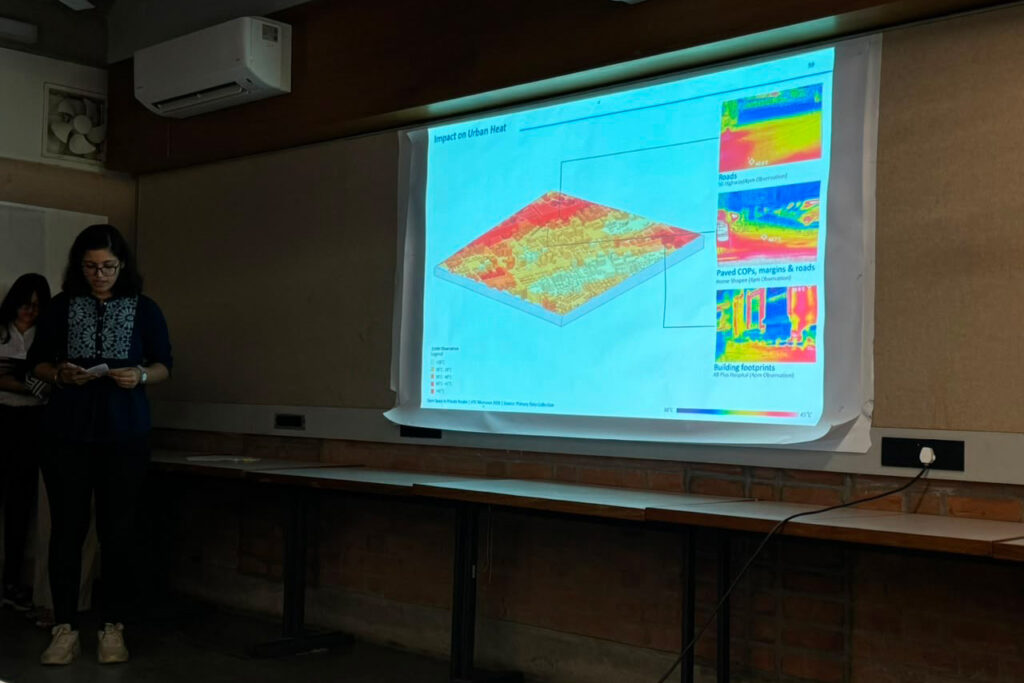
The study extends to the city scale, examining changes in green cover, impermeable surfaces and land surface temperatures over time. NDVI-based green cover mapping helps reveal the reduction and changing distribution of vegetation, while thermal and impervious surface assessments highlight the relationship between declining green cover, increasing paved surfaces and urban heat. Together, these analyses reveal how spaces mandated as open areas frequently become paved surfaces, parking lots and residual margins, contributing to a more impermeable and hotter urban environment.

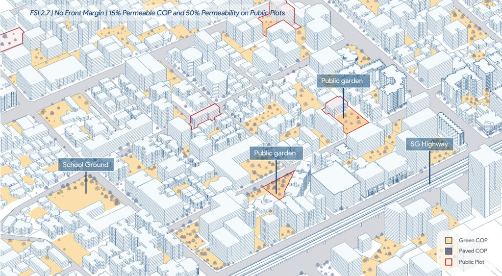
By connecting regulatory provisions with conditions on the ground and city-wide environmental changes, the study questions whether current regulations are achieving their intended purpose. It explores how private open spaces, rather than remaining residual or underutilised areas, could be reimagined as meaningful, connected and environmentally functional parts of Ahmedabad’s urban fabric.
Plot level Analysis

Increasing impermeability 2016- 2026 

2016
2026

Urban heat 2016- 2026 

2016
2026

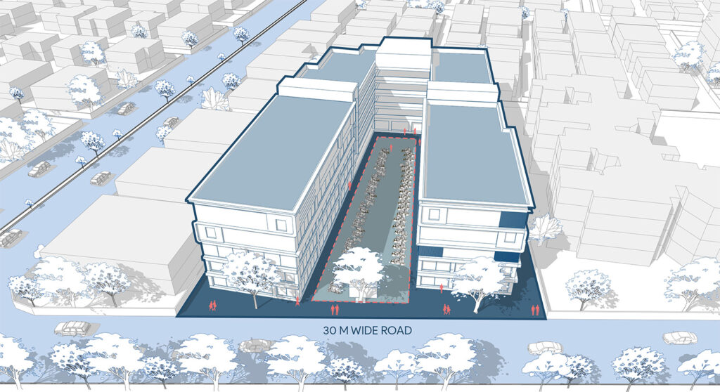
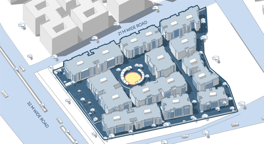
Existing to possible scenarios