Urban Landscape Futures: Flows, Commons, and Shifting Grounds
Studio Overview
Along the edges of the Sant Sarovar Dam and its adjoining riverbed, the terrain has been shaped by continuous cycles of sand extraction, large infrastructural projects, and redirected water flows that carve new channels into the riverbed. The site reflects conditions increasingly visible across rapidly urbanising Indian cities, where infrastructure, settlement, ecology, and public life remain in constant negotiation. The resulting terrain is unstable, fragmented, and continuously contested.
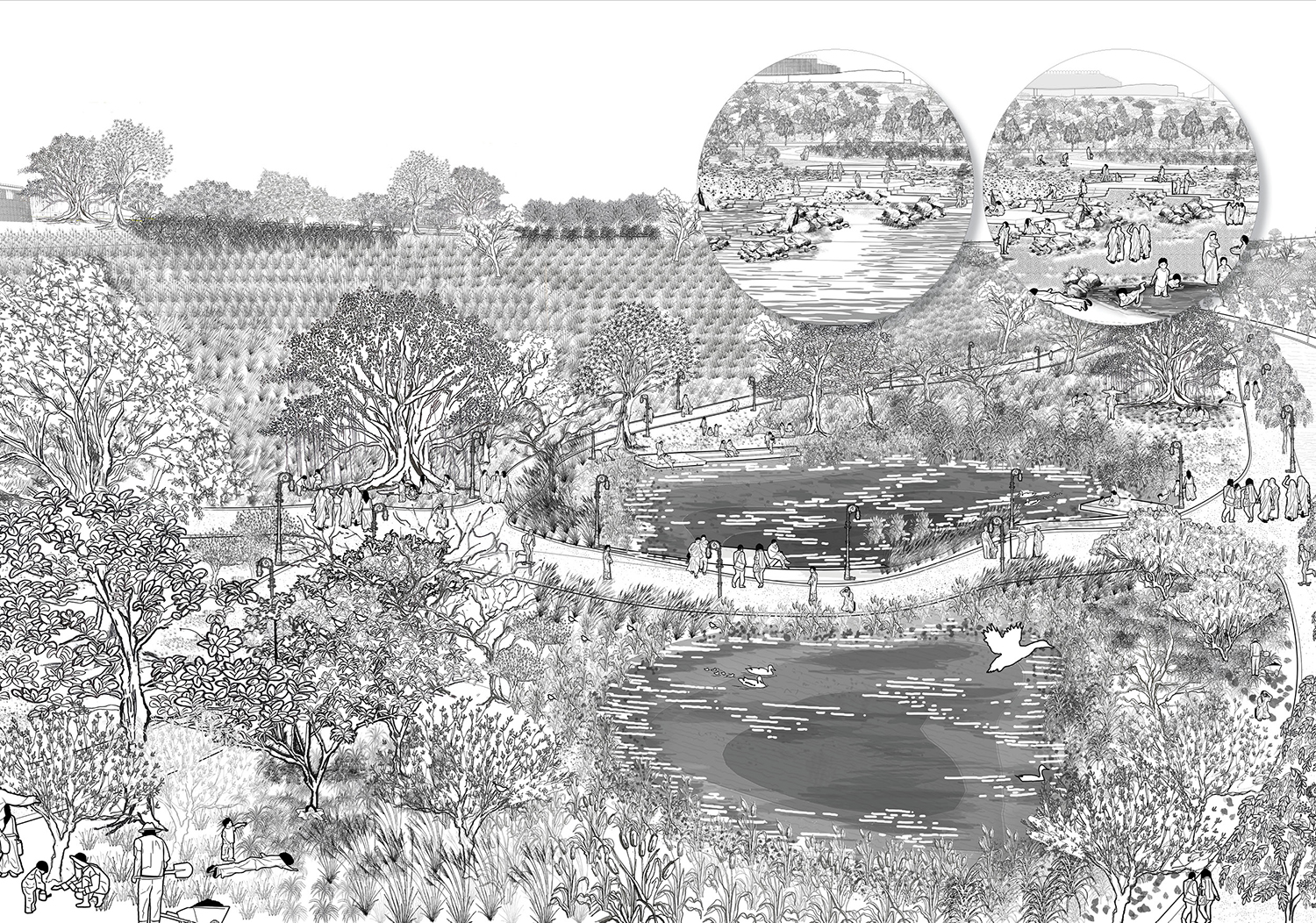
At the same time, the river edge is actively used by surrounding communities for gathering, fishing, birding, swimming, grazing, and informal recreation, despite the absence of adequate social and safe public infrastructure. Seasonal fluctuations reshape the landscape, revealing dry riverbeds, unstable slopes, and shifting commons that are repeatedly occupied, negotiated, and transformed through everyday use.
The studio responds to contemporary approaches that engineer river landscapes through diverted water systems and hardened concrete embankments. Such interventions often reduce rivers to controlled corridors rather than dynamic systems capable of absorbing flux and shocks. Beyond the floodplain, the studio engages the broader terrain, including natural slopes, ravines, exposed grounds, and existing patterns of occupation. Semi-arid ecologies, seasonality, and fluctuating riverine conditions become central to rethinking the river corridor as an adaptive ecological and public realm.
Field Studies
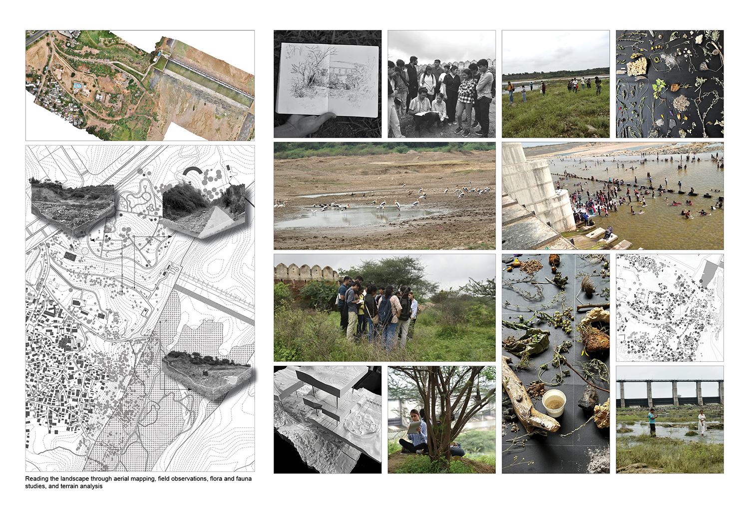
Students engage with the site through field observation, mapping, walking, drawing, spatial analysis, and stakeholder interviews to understand how hydrological systems, soil conditions, vegetation patterns, and human occupation intersect over time.
Particular emphasis is placed on reading thresholds, slopes, exposed grounds, abandoned edges, and negotiations between built and natural systems. Through this process, design emerges not as a predetermined solution, but as an inquiry grounded in detailed observation and contextual knowledge.
Studio Structure
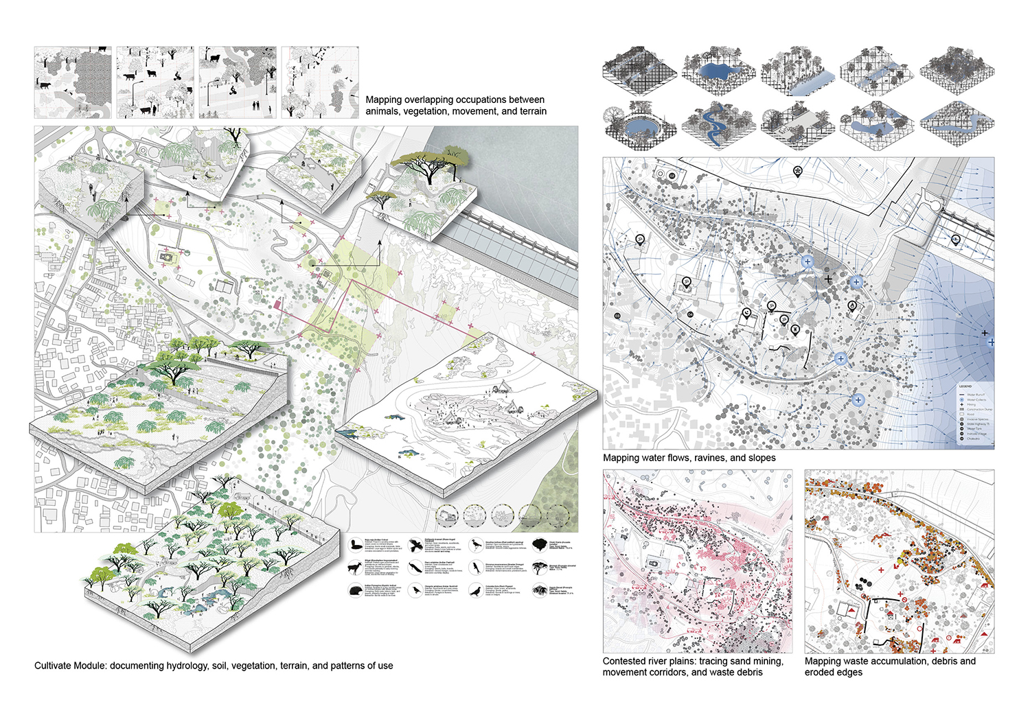
01. Cultivate: Reading Landscapes | Weeks 1–4
Develop methods for observing and documenting complex urban landscapes.
Map visible and invisible processes shaping the site, including hydrology, soil, vegetation, and human use.
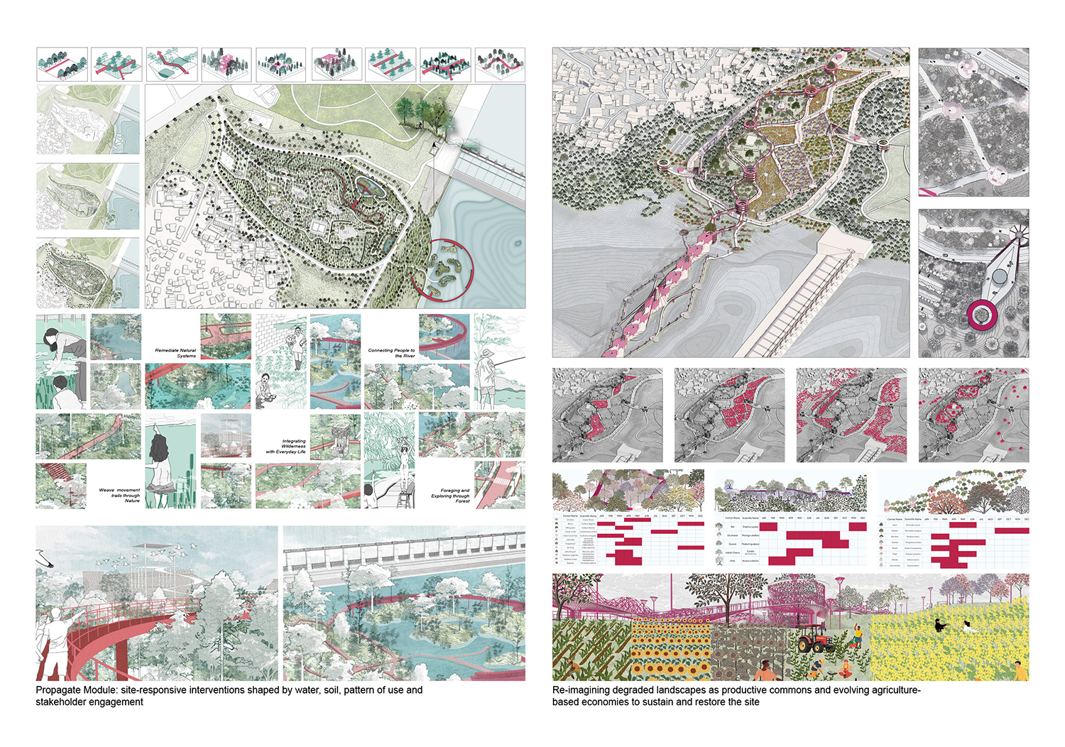
02. Propagate: Propositions and Futures | Weeks 5–10
Develop site-responsive design strategies rooted in ecological processes.
Explore adaptive and incremental interventions rather than fixed design plans.
Propose productive landscapes that engage water, soil, and community use.
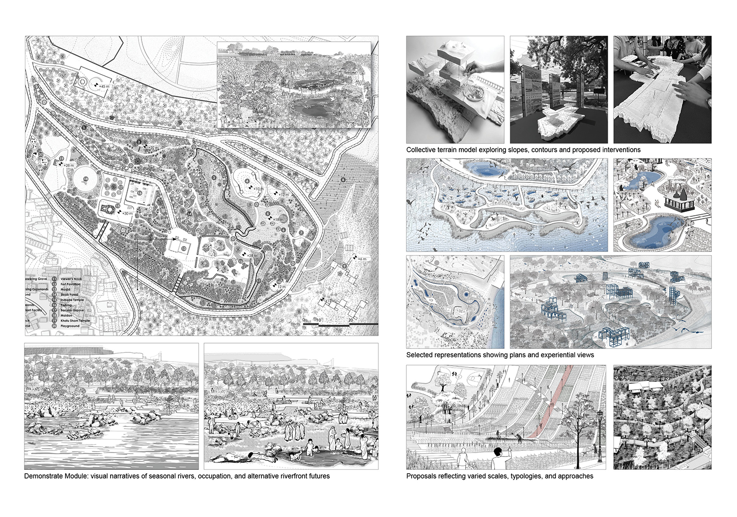
03. Demonstrate: Representation and Communication | Weeks 11–16
Translate ideas into clear visual and spatial narratives.
Develop drawings, models, and imagery to communicate design proposals effectively.
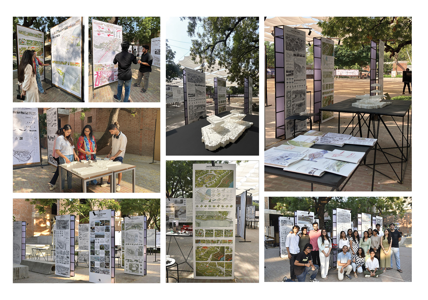
Outcomes and Impact
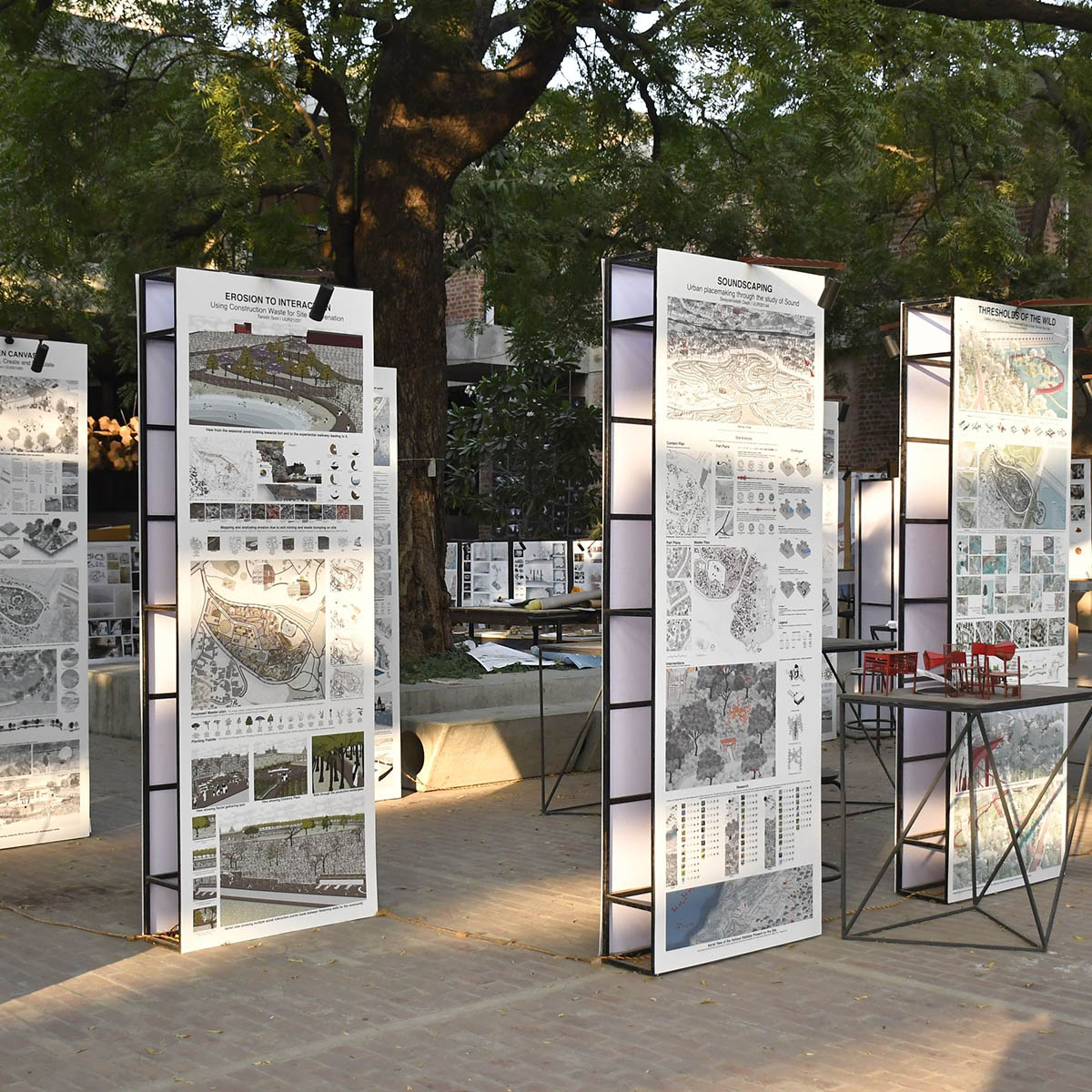
The studio equips students with methods to work within fragile and contested river landscapes through direct engagement with semi-arid ecologies, seasonal flux, hydrological systems, and diverse patterns of use. Students develop an understanding of planting strategies responsive to local ground conditions, climate, riparian edges, fluctuating wetness, disturbed terrain, and eroded or contaminated soils. The studio generates a range of speculative yet grounded proposals, from landscape-led interventions and adaptive public infrastructure to productive ecological strategies linked to local economies. Several student projects emerging from the studio have received recognition through exhibitions, publications, and academic awards, reflecting its emphasis on rigorous field engagement, critical inquiry, and ecology-first design thinking.